Quick Escapes: 10 Trails Near Major Cities

'Hohokam Petroglyphs, Phoenix's South Mountain (Jon Mancuso)'

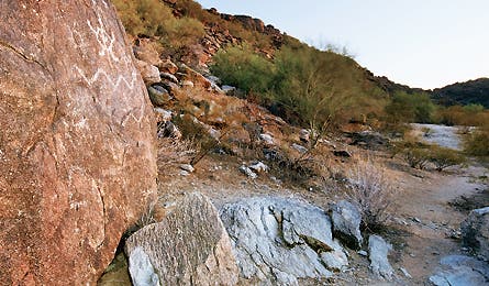
Hohokam Petroglyphs, Phoenix’s South Mountain (Jon Mancuso)

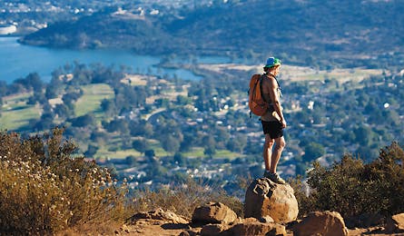
San Diego, CA (Brett Holman)

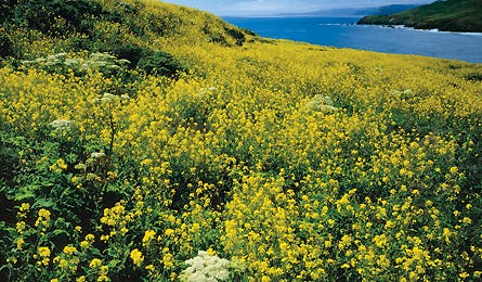
Coastal Trail, Golden Gate Recreation Area (Ed Callaert)
Phoenix | San Diego | San Francisco | Boston | New York | Philadelphia | Chicago | Seattle | Los Angeles | Austin
Phoenix, AZ
Desert rats don’t have to travel far for a cactus-and-coyote fix.
Aficionados disagree about which city park is the country’s largest. Some count state and federal parks located near (but not in) a city, in which case Anchorage’s 490,125-acre Chugach State Park beats all comers. But when considering municipal parks that are within a city’s physical, cultural, and civic boundaries, Phoenix’s South Mountain Preserve takes the prize. At more than 16,000 acres, it’s no exaggeration to say the park is big enough to get lost in. Best plan: Connect the Alta, Bajada, and National Trails, on the park’s remote west side, for a challenging eight-mile loop. Most visitors stick to more accessible areas and smoother trails, so this route–steep, rocky, and rough in places–is perfect for solitude-seeking hikers. En route, you’ll pass Sonoran highlights like towering saguaros and, in spring, blooming barrel cactus and prickly pear. Note: Start at the Alta trailhead the first weekend of every month; at other times, due to a road closure, park at the Ranger trailhead and add 4.2 miles (total). phoenix.gov/parks
Phoenix | San Diego | San Francisco | Boston | New York | Philadelphia | Chicago | Seattle | Los Angeles | Austin
San Diego, CA
See SoCal the way it was.
Think this city by the sea is all beach? Think again. According to the Trust for Public Land, it has one of the highest park-land-per-capita rates in the country (36.2 acres per 1,000 residents). It’s easy to find your slice. In town: Balboa Park’s Trail #5 makes a 6.6-mile loop that passes through Palm Canyon, an oasis fed by an underground stream (balboapark.org). Close to town: Climb San Diego’s 1,591-foot high point on the Cowles Mountain Trail (three miles round-trip). It’s in Mission Trails Park, eight miles northeast of town. mtrp.org
Phoenix | San Diego | San Francisco | Boston | New York | Philadelphia | Chicago | Seattle | Los Angeles | Austin
San Francisco, CA
Stretch your legs on coastal trails in the Marin Headlands.
It’s hard to beat this urban/wilderness interface: San Fran residents who live on the north side of the city can hike from their front doors to a backcountry campsite in the Marin Headlands. Just cross the Golden Gate Bridge, descend to the Coastal Trail, and hike north, connecting the SCA, Alta, and Bobcat Trails to reach Hawk Camp. (It’s about six to seven miles one-way, depending on your address; alternatively, start at the Morning Sun trailhead–served by Golden Gate Transit–and hike in two miles.) En route, you’ll get postcard views of the bay from the headlands’ open meadows. At Hawk Camp, you’re literally surrounded by trails. Best route: Trek out to Rodeo Beach by linking the Miwok, Wolf Ridge, and Coastal Trails. Secluded Hawk Camp has ocean views on clear days, and is often available on short notice fall through spring (pack water; reservations required). Live on the south side of the city? See page 70 for a summit hike near you. nps.gov/goga
Phoenix | San Diego | San Francisco | Boston | New York | Philadelphia | Chicago | Seattle | Los Angeles | Austin
Boston, MA
Find total rejuvenation on three sides.
The key here to a quick getaway: Don’t waste time driving west to the mountains. Live in city center? A 15-minute ferry ride lands you on Spectacle Island, part of the Boston Harbor Islands National Recreation Area (bostonharborislands.org), where you’ll find five miles of trail and a hilltop with views of the city. Or, for a surprisingly wild overnight, head to Lovells Island and its three secluded campsites. Northside hikers: Head to Walden Pond State Reservation, 15 miles northwest of town. Only 1,000 visitors per day are allowed, which might strike Thoreau as a crowd but is actually an improvement (in the 1930s officials estimated there were 25,000 bathers here on each summer Sunday). Near the boat launch, pick up the Esker Trail on your left. This rugged, two-mile route along a glacial erratic affords some of the best views of the pond. After half a mile, go left on Emerson’s Cliff Trail and climb to the park’s highest point. Continue to lush Heywood Field, an oasis for gray tree frogs, leopard frogs, and snapping turtles. Go right on Heywood’s Meadow Path and loop back on the Esker Trail for a four-mile circuit (mass.gov/dcr/parks/walden). Southside residents: Your closest hiking is in the 7,000-acre Blue Hills Reservation (mass.gov/dcr/parks/metroboston/blue.htm), which has a sprawling 125-mile trail network just minutes from town.
Phoenix | San Diego | San Francisco | Boston | New York | Philadelphia | Chicago | Seattle | Los Angeles | Austin
New York City, NY
Find a rare slice of woodland quiet in the original big-city park.
Central Park is the country’s most popular urban green space, with about 25 million annual visitors (for comparison, that’s almost three times more than the most popular national park). But even in the heart of Manhattan you can find a spot that feels like wilderness (all things considered). Kate Sheleg, of the Central Park Conservancy, says the secret slice of wild is in the North Woods section. Enter the park at The Pool entrance, at Central Park West and 102nd Street. Head north on West Drive to the North Woods, and wander at will on unmarked paths (stop at the Charles A. Dana Discovery Center–110th between 5th and Lenox–to pick up an area map). The 90-acre hideaway harbors several waterfalls, including one 14-footer, all hidden in a dense stand of black cherry, American beech, oak, and maple trees. The wildflower meadow in the stream-fed Ravine, with aster, jewelweed, and woodland goldenrod, has the most diverse collection of flora in the city. centralparknyc.org
Phoenix | San Diego | San Francisco | Boston | New York | Philadelphia | Chicago | Seattle | Los Angeles | Austin
Philadelphia, PA
Get a workout on a surprisingly hard trail in this sea-level city.
Easy escape plan: Jump on the SEPTA R8 regional rail line to the Chestnut Hill section of the city, at the northeast corner of Wissahickon Valley Park, and disappear into this 1,800-acre preserve and its 57 miles of trails. Best training hike: Take the hilly 4.5-mile White Trail (starting at Park Line Drive and Hortter Street). If you want something long but mellow, hike the Orange Trail; it runs along the park’s entire seven-mile-long east side. Keep an eye out for white-tail deer and snapping turtles, as well as the native euynomous tree, a fast-growing evergreen that produces white flowers and red berries in late summer. fow.org
Phoenix | San Diego | San Francisco | Boston | New York | Philadelphia | Chicago | Seattle | Los Angeles | Austin
Chicago, IL
Paddle to solitude on the Windy City’s big river.
The lakefront is great for people-watching, but local paddlers know that the city’s sweetest escape is the Chicago River, whose willow- and maple-lined banks provide habitat for muskrats, blue heron, cormorants, and snapping turtles–and plenty of mellow water for canoes and sea kayaks. For a quick getaway, put in at the 3400 N. Rockwell launch (just west of the soccer field) and cruise north through a verdant channel. You’re heading toward Lake Michigan, but you’ll be paddling upstream; engineers reversed the river’s flow in 1900 to divert polluted water away from the city. Turn around at the dam at mile 2.3. Looking for a longer adventure? Put in at the Skokie Lagoons (20 miles from downtown) and explore seven miles of interconnected pools and marshes. Note: Avoid paddling right after heavy rains, when the Chicago River can contain high levels of bacteria. chicagoriverpaddle.com
Phoenix | San Diego | San Francisco | Boston | New York | Philadelphia | Chicago | Seattle | Los Angeles | Austin
Seattle, WA
Find a surf-and-turf adventure at Discovery Park.
With the Olympics, Rainier, and the Cascades tantalizingly close, Seattle hikers have no lack of nearby destinations. But even those won’t do when you need a fix within 15 minutes. For that, head to Discovery Park on the west side of the city. The former military site encompasses 534 acres, with 12 miles of trails and two miles of protected beaches along Puget Sound. Take the 2.8-mile Loop Trail through Douglas fir, western red cedar, and big leaf maple. Thick forests give way to meadows at the South Beach Trail junction, which allows access to the shoreline. (Descending to the beach adds 300 feet of elevation change to your hike.) Kayakers: Start from the hand-carry launch at Golden Gardens Park, two miles north. And yes, on clear days you can see Mt. Rainier and other nearby peaks. cityofseattle.net/parks/environment/discovparkindex.htm
Phoenix | San Diego | San Francisco | Boston | New York | Philadelphia | Chicago | Seattle | Los Angeles | Austin
Los Angeles, CA
The best vista in Hollywood? Right under its iconic sign.
No need to brave freeway gridlock to stretch your legs. Griffith Park–with 4,000 acres of open space–lies right in the Hollywood Hills. And its best trails aren’t overrun, because the park’s surprisingly sharp vertical gain discourages casual hikers. Top hour-long escape: Enter at the Cadman Drive entrance and drive to the start of the Coolidge Trail, on the left. Ascend switchbacks up the mountainside to a bird’s-eye view of Glendale and downtown L.A. At the intersection of the Upper Beacon and Fern Canyon Trails (at 1.1 miles), stay left on Upper Beacon for 300 yards, then snake 1.2 miles down the Lower Beacon Trail to close the loop. ci.la.ca.us/rap/dos/parks/griffithPK/index.htm
Phoenix | San Diego | San Francisco | Boston | New York | Philadelphia | Chicago | Seattle | Los Angeles | Austin
Austin, TX
Practice your river crossings on Barton Creek.
Twenty-nine trails within Austin’s city limits extend for more than 1.5 miles each. But the real treasure here, as all locals know, is Barton Creek Wilderness Park, a 1,021-acre wooded preserve on the west end of the Barton Creek Greenbelt. Access the Barton Creek Wilderness Trail from the southwest edge of Zilker Metropolitan Park. You’ll see others on this seven-miler, but to find the best elbowroom, continue a mile past popular Twin Falls, to Sculpture Falls and its deep swimming hole. Or go after heavy rains; the waist-high creek crossings mean you’ll likely have it all to yourself. austinparks.org