Heading out the door? Read this article on the new Outside+ app available now on iOS devices for members! Download the app.
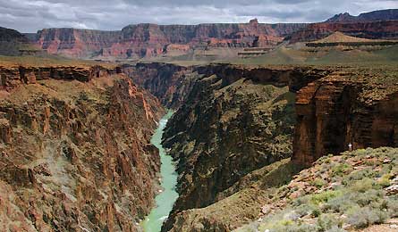
Overlooking Granite Gorge (Valerie Long)
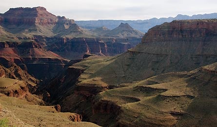
Hance Creek From Horseshoe Mesa (Valerie Long)
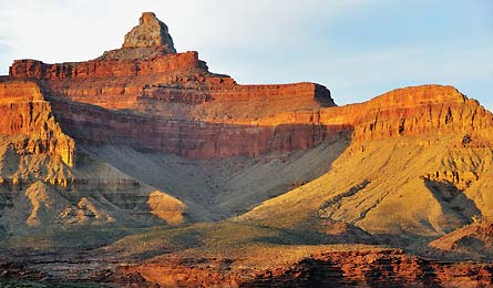
View Of 7,128-Foot Zoraster Temple (Michael Lanza)
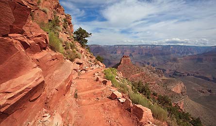
South Kaibab Trail (Sasha Buzko)
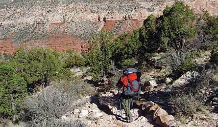
Hermits Rest To Dripping Springs Dayhike (Elias Butler)
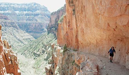
Upper North Kaibab Trail (Michael Lanza)
TRIP PLANNER | ASK A RANGER | GRAND PHOTOGRAPHY | TRIP FINDER
I kick the microspikes on my boots into the hardpacked snow and ice coating the trail. Then I start taking short, deliberate steps, following an old mining path barely more than a foot wide. A slip here could end with a plunge hundreds of feet off the sheer cliff.
With my free left hand, I grab reflexively at scraggly little weeds protruding from cracks, as if they would hold my weight against a fall. With my other hand I clutch the fingers of my 7-year-old daughter, Alex, as she inches along the same scary traverse, just in front of me. And just in front of her, my 9-year-old son, Nate, and my wife, Penny, finish navigating this treacherous stretch of trail. It’s only 20 feet of ice, but it feels like a mile.
Penny and I wanted to introduce our kids to the Grand on an intimate, in-your-face level, not just a South Rim drive-by or inner-corridor mob walk, and we figured it’d be better to take our chances with the possibility of spring ice at the 7,400-foot rim than wait until summer’s guaranteed triple-digit temps. So we decided to spend our kids’ spring break on the four-day, 26.8-mile trek from Grandview Point to the South Kaibab trailhead, which offers the park’s best balance between easy access, deep-canyon scenery, and smaller crowds (except the route’s beginning and end).
Even without ice, the Grandview Trail is intimidating–it drops 3,500 feet in 4.5 miles–but it’s not technical. Soon we sink below the freezer zone and zigzag down to Horseshoe Mesa. We’ve walked into the desert in full spring by the time we hit the Tonto Plateau. We shed our microspikes and fleece jackets, and walk in 70-degree afternoon sunshine down to our first campsite, an inner-canyon oasis of shade trees on Cottonwood Creek, four miles in. Up here near its headwaters, the creek is a slender stream gurgling below red cliffs. But a mile farther downstream, it carves a ragged, 1,000-foot-deep side canyon explorable all the way down to an impassable pouroff.
On our second day, we hike a half mile downstream and turn west onto the Tonto Trail. We’ll follow this for the next 18 miles, to our exit on the South Kaibab Trail. Hiking for three days on the Tonto Trail is unlike any other Grand Canyon hike: Instead of the exhausting elevation change you get on rim-to-river routes, you cross the gently rolling Tonto Plateau, staying between 3,600 and 3,800 feet the whole way.
And make no mistake: Though we won’t descend to the Colorado River, the mezzanine-level views on the Tonto are unmatched. We gaze out at crooked fingers of ridges, like Ottoman Amphitheater and Wotans Throne, reaching toward us from both rims. This mid-canyon perspective–when you’re deep in the belly of erosion, but can still see the massive canyon sprawling above and below and to the sides–is the highlight of a rim-to-river trek; on the Tonto Trail, it’s what you see the whole time. We look across a sere landscape of prickly pear and giant beavertail cacti, sagebrush, and broken plates of sedimentary rock. Later in April, prickly pears will light up the plateau with their big, brilliant red and yellow flowers.
We circle around deep gashes made by tributary creeks like Grapevine, Boulder, and Lonetree. These “side” canyons are so spectacular they’d probably be national parks unto themselves anywhere else. And while designated backcountry campsites on popular hikes are virtually always full, the Tonto offers at-large, all-to-yourself nights and few encounters with other hikers during the day.
The quiet affords Penny and me more one-on-one time with Alex and Nate than we ever have at home—listening to their simple, awestruck exclamations, or curling up together in a cool refuge of shade during the midday heat. This is what we came for.
On our last night, we camp on the plateau between Lonetree and Cremation Canyons, in wind that would carry the tents to Utah if we didn’t stake them out well. By early evening, the sun drops behind the rim, but dusk lasts for two hours, setting the tips of the tallest formations ablaze. Across the canyon, the 3,000-foot-tall walls of Zoroaster Temple cleave the sky like a red warbonnet, and the sun’s last rays soften the cliffs of the North Rim. We have eight miles and 4,000 feet of climbing tomorrow–a tough haul for my young kids. But tonight, we’re enjoying that sweat equity: a private campsite with a view of time itself.
TRIP PLANNER | ASK A RANGER | GRAND PHOTOGRAPHY | TRIP FINDER
TRIP PLANNER
The Way The way The park is 77 miles northwest of Flagstaff via US 180 and AZ 64. Start: Take Desert View Dr. 12 miles east to Grandview Point. End: Shuttle via taxi; (928) 638-2822.
Season March to May and October to November. Inner canyon temps from June to September are often above 100 degrees.
Key gear Wide-brim hat and six liters of water storage
Map/book Trails Illustrated Grand Canyon ($12, natgeomaps.com). Hiking Grand Canyon National Park, 3rd Edition, by Ron Adkinson and Ben Adkinson ($19, falcon.com)
Permits $10 per permit, plus $5/person per night. Apply (nps.gov/grca/planyourvisit/backcountry-permit.htm ) on the first of the month four months prior to your hike date (e.g., June 1 for a hike beginning in Nov.) and fax it to (928) 638-2125.
Water There are four water sources along this route, and only Grapevine Creek (mile 8.8) flows year-round. The other sources–Cottonwood Creek (mile 3.3), Boulder Creek (mile 14.2), and Lone Tree Creek (mile 17.1)–usually dry up by June.
Contact Backcountry Information Office: (928) 638-7875 (from 1 to 5 p.m., Monday to Thursday), nps.gov/grca
Trip data Download a GPS track, complete with waypoints and turn-by-turn directions, at backpacker.com/hikes/deepspace.
TRIP PLANNER | ASK A RANGER | GRAND PHOTOGRAPHY | TRIP FINDER
ASK A RANGER
Q: Any special tricks for staying cool during summer?
A: Rangers always advise visitors to pack at least a gallon of water per person per day, use it to dampen their hats and shirts, and avoid the heat of the day, says ranger Dean Reese. “Sitting out the sunny hours is not practical for rangers, though, so we carry spray bottles–not a bad idea for hikers, either.” Keep a spray bottle handy, and use it to spritz your face and neck often to aid in evaporative cooling. The few ounces can make hot days a little more comfy.
TRIP PLANNER | ASK A RANGER | GRAND PHOTOGRAPHY | TRIP FINDER
GRAND PHOTOGRAPHY
Take pictures as spectacular and memorable as the canyon itself.
For most photographers, the Grand Canyon is equal parts inspiring and intimidating. Its scale tempts you to shoot only sweeping vistas, but such a strategy can yield unsatisfying images that fail to convey the canyon’s tremendous depth. Follow this sequence:
1. Shoot early or late in the day, when shadows give the canyon its most three-dimensional quality.
2. Use an ultra-wide zoom, like a digital 10-20mm, to capture good depth-of-field in the background.
3. Think about your foreground as much as the background. Get low and up close to a visually appealing subject, like a blooming prickly-pear cactus or a creek spilling over a red-rock ledge.
4. Frame your shot to include a striking formation in the distant background and some sky–but place the horizon in the upper third of your image.
5. Shoot at f/16 or higher to keep both foreground and background in focus.
TRIP PLANNER | ASK A RANGER | GRAND PHOTOGRAPHY | TRIP FINDER
RIGHT PLACE, RIGHT TIME
Find the perfect Grand Canyon trek no matter when you visit.
DAYHIKE
Hermits Rest to Dripping Springs
Time April
Most of this 6.2-mile out-and-back melts out by early March, but after the junction with the Boucher Trail (mile 2.6), it can still be icy. Time your trip for late March to early May, when snowmelt feeds this famously scenic tributary with a higher-than-normal volume of water. Avoid the trail from June to September, when the inner canyon sizzles. Total mileage6.2
WEEKEND
Grandview to Horseshoe Mesa
Time Mid-March; October-November
Take a chance on icy rim-top trails (stay safe with light crampons like Kahtoola Microspikes: $60, kahtoola.com) in mid-March and you’re likely to have the sweeping views, exciting exposure, and bright yellow carpets of brittlebrush blooms all to yourself. Camp on the mesa. There’s reliable water at Miner’s Spring (drop east off Horseshoe Mesa and hike .7 mile). Downside: frequent spring wind. Go in fall for calm, bluebird days in the 50s to 70s. Tip: Add another day to explore to the edge of the Inner Gorge. Total mileage 11.9 Trip ID823945
MULTIDAY
Tanner Trail to Beamer Trail
Time March-May; September-November
Constant exposure to the sun shuts down the Tanner Trail by early June. Try this experts-only, 37-mile out-and-back to the Little Colorado River Gorge in fall and spring (cautions: the trail is loose, steep, long, and devoid of water). In summer (mid-June to September), thunderstorms can produce flash floods here. Total mileage 37. Trip ID515868
MULTIDAY
North Bass Trail
Time Late May; October-November
Snow, ice, and fallen trees typically block road access to this 22-mile North Rim-to-river hike until June. But by then, the trail is off-limits due to triple-digit heat and the threat of flash floods after summer thunderstorms. Check with rangers about a sneak trip in late May, or target the fall and take your time (three days) on this difficult hike. Expect routefinding around boulders in Shinumo Creek, long arid sections, and bushwhacks through manzanita. The reward: cascading waterfalls and an expansive canyon all to yourself. Total mileage 22
MULTIDAY
Hermits Rest to Bright Angel
Time All year
Early-season snow melts first on south-facing aspects, and two perennial water sources (Hermit and Monument Creeks) make this 24.8-mile, three-day, inner-canyon ramble the park’s best bet for a year-round backpack. In April, the Tonto Plateau (where you’ll hike for 10.5 miles) is lit by prickly pear cacti exploding in lemon yellow, red, or purple blossoms. Total mileage 24.8