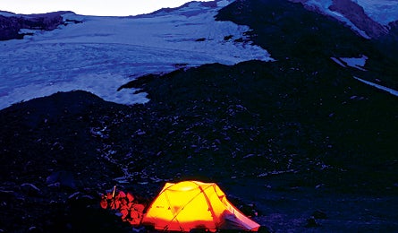
Mt. Adams: Solitude On Ice

'(Dave Schiefelbein)'
The Hike
The slopes of hulking 12,276-foot Mt. Adams boast enough snow and ice routes
to satisfy every level of mountaineer. Most climbers hit the easy one- to two-day
stroll up the South Spur route, but to put budding mountaineering skills to
a true test, summit via the Mazama Glacier route. You’ll spend a night at Sunrise
Camp, 3.5 miles from Bird Creek Meadows trailhead, then on summit day work west
through talus fields to the Mazama Glacier. Rope up to climb a 35-degree snow
slope with crevasse hazards to a false summit at 11,657 feet. From here, it’s
a nearly level stroll to the true summit. Block out three to four days for this
12-mile roundtrip with 6,000 feet of elevation gain.
The Crux
Navigating crevasse-laden terrain.
The Key
On summit day, budget eight hours to reach the top, leaving camp by 2 a.m. in
order to cross snowbridges before they weaken in the heat of the day. Stay to
the right on the Mazama Glacier to avoid the most crevasse-perforated areas.
Use wands to mark your route. Retrace it on the waydown, but be prepared
to descend the easier (and crevasse-free) South Spur if the weather becomes
questionable.
The Way
From Trout Lake, head 4.5 miles north on Mt. Adams Rd. to NFD-82. Turn right
and go six miles to the Yakima Indian Reservation boundary. Turn left here onto
NFD-8290 and Bird Creek Meadows.
Plan It
(509) 395-3400; fs.fed.us/gpnf/recreation/mount-adams.
USGS quads: Mt. Adams East, Mt. Adams West