Updated March 18, 2024 06:33PM
One Bridge, Two Trails: Hike Michigan's Manistee River Trail and North Country Trail
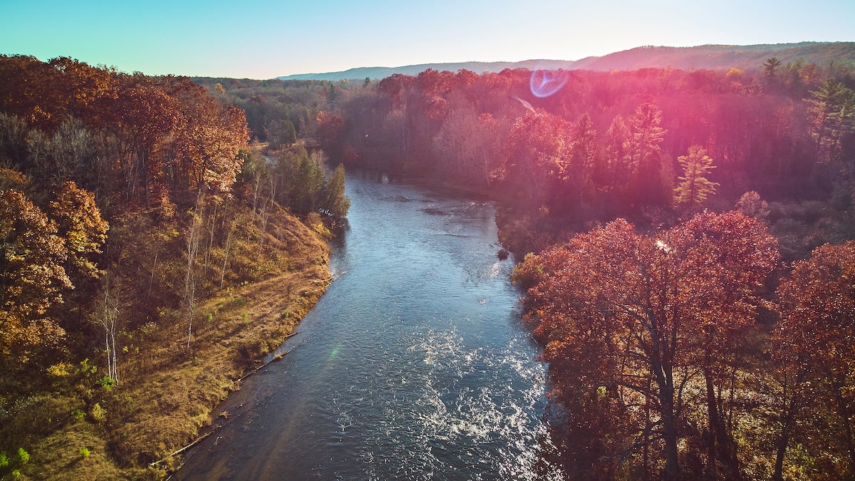
Two trails, same river, two different worlds.
(Photo: Nicholas Klein via Getty Images)
What a difference a bridge makes. It used to be you couldn’t hike the North Country Trail (NCT) through Huron-Manistee National Forests without a two-car shuttle or planning an out-and-back hike. Hikers couldn’t pass the Manistee River until 1996 when a suspension footbridge opened, connecting the Manistee River Trail across the river to the NCT. This is also the largest wooden suspension bridge in Lower Michigan. The result is a weekend-size, 23-mile loop that offers some of the best views and most varied hiking in the Lower Peninsula. And you can leave the extra car at home.
The Manistee River Trail and North Country Trail each has a unique character. Long views and rugged hiking typify the NCT as it climbs hill after hill through tall pines and hardwoods that tower over the Manistee River, culminating in the view of nothing but trees, hills, and river from atop Red Hill: a rare lower peninsula high spot that doesn’t come with a ski resort. On the east side of the river, the Manistee River Trail rolls across smaller hills and flats, where waterfalls, streams, wetland boardwalks, and high, cut-away riverbanks characterize the land. It’s impressive not for the views, but for the variety. The diamond blazes keep hikers on track and footbridges keep boots dry.
There’s ample parking at all trailheads. We recommend starting from the Marilla and Upper River Road trailheads for the Nouth Country Trail and the Red Bridge and Seaton Creek entry points for the Manistee River Trail. However, the road to Seaton Creek Campground Trailhead may be impassable, especially in winter. If you park at the Marilla Trailhead instead, you’ll have a long, steep uphill climb to finish your hike. If you hike south on the NCT segment be sure to watch for the Manistee River Trail spur that heads southeast down to the river. It’s heralded with a confusing wooden sign reading “North Country Trail.” Pass it and you’ll hike an extra 2 miles, but considering the pleasant surroundings, worse things could happen.
Hike It: Manistee River Trail
DRIVE TIME: The Manistee River Trail is located in Michigan’s Lower Peninsula, about 270 miles (5 hours) northwest of Detroit, and 300 miles (51/2 hours) northeast of Chicago.
THE WAY: From Grand Rapids, take U.S. 131 north to Cadillac. Follow MI 55 west for 20 miles, then turn right on Warfield Road. After 5 miles, turn left on Coates Highway, and the Red Bridge Access parking lot is 2 miles ahead on the left just after the bridge. Trailheads are across the road. To reach the Marilla Trailhead from MI 55, take MI 37 north to Mesick, turn left on MI 115, left on Beers Road and left at the North Country Trail sign.
TRAILS: Huron-Manistee National Forests contain 120 miles of the North Country Trail. The Manistee River Trail, together with a portion of the NCT, forms a 23-mile loop of varied hiking. The Manistee River Trail follows the east shore of the Manistee River for 8.8 miles through rolling hills through wetlands and bridges over creeks. Red Hill tops out at 1,105 feet, and the trail descends to about 700 feet through Flower Flats.
PERMITS: You don’t need a permit to hike this trail, but you need to pay some fees for day use. For the North Country Trail’s Marilla Trailhead, you’ll need to pay a Recreation Enhancement Act fee for day use. You’ll also need to pay the Concessionaire Fee for day use at the Seaton Creek Campground.
CAN’T MISS: The best views are along the NCT between Marilla Trailhead and Red Hill. On the Manistee River Trail side you’ll find an 8-foot-high waterfall 2 miles south of the suspension bridge. Several observation sites along the trail are primed for Manistee River and surrounding area views.
CROWD CONTROL: Summer weekends are popular with anglers, canoers, mountain bikers, and hikers. This area is known for fall colors, and deer season is best avoided. Spring and fall midweek hikers will find absolute solitude.
WALK SOFTLY: Rangers ask that you camp at least 200 feet from the river unless you’re at a designated campsite. Stay on the trail in the delicate waterfall glade and wetland areas.