Updated December 4, 2024 03:05AM
Interactive Map: America's Public Lands
Being American makes you part owner of some of the finest terrain in the world. Better get a handle on your portfolio.
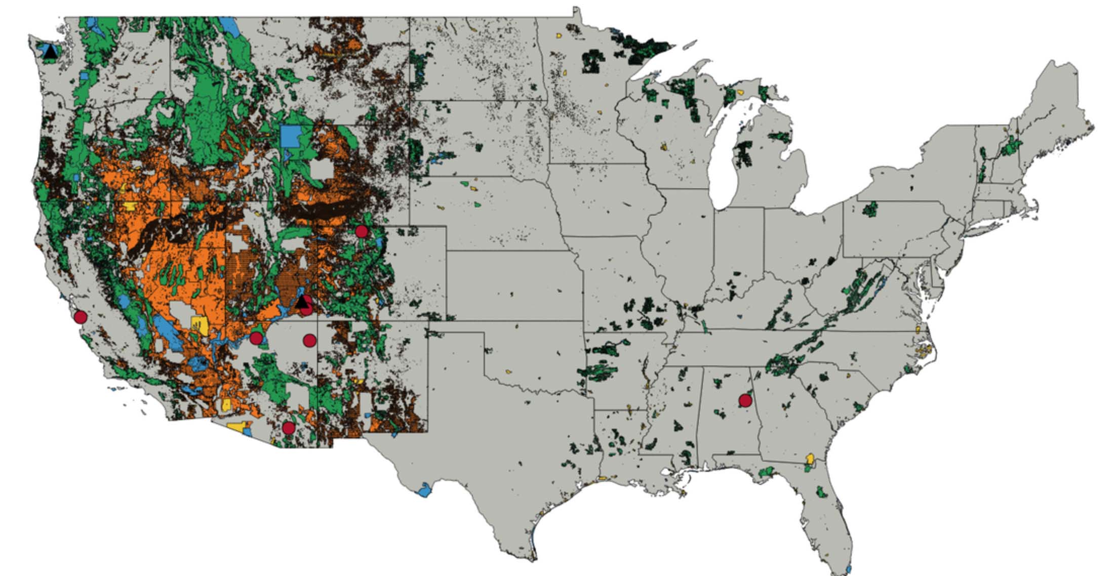

One million square miles: That’s how much federal land is in the United States. But that number alone doesn’t do justice to the parks, forests, deserts, and trails that backpackers call home. Use our interactive map to browse BACKPACKER’s coverage of America’s public lands—or find out what’s outside your door.
Tip: See your location by pressing the geolocate button underneath the zoom controls.
Public Lands By The Numbers

Busiest NPS Site: Golden Gate National Recreation Area, 15,638,777 visits (2016)
Least Busy NPS Site: Aniakchak National Monument and Preserve, 100 visits (2016)
Highest Percentage of Federal Ownership: Nevada, 81%
Lowest Percentage of Federal Ownership: Connecticut, 0.2%
ADVERTISEMENT
Who Runs Public Lands?
Bureau of Land Management
- Land: 383,000 square miles
- Budget: $1.3 billion
Forest Service
- Land: 300,000 square miles
- Budget: $6.2 billion
Fish and Wildlife Service
- Land: 156,000 square miles
- Budget: $3 billion
National Park Service
- Land: 132,000 square miles
- Budget: $3 billion
Other Agencies
- Land: 29,000 square miles
Most Controversial Public Lands

Grand Staircase-Escalante and Bears Ears National Monuments, diminished in December 2017
Most Vulnerable Public Lands

Cascade-Siskiyou and Gold Butte National Monuments, earmarked for reduction