Updated July 10, 2025 09:19AM
In Praise of the Second-Highest Mountains
With mountains, being the highest doesn’t always mean being the best. This fall, raise a trekking pole to America’s best dayhikeable penultimate peaks.
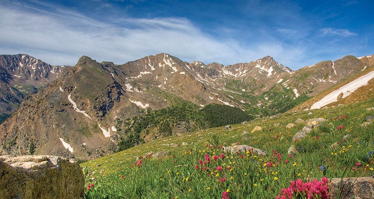
'Nab this view of Thirteeners from the path up Massive (flowers bloom July and August).
Mt. Massive
Mt. Massive Wilderness, Colorado
The state’s second-highest peak inspires awe, art, and an unusual degree of devotion. In the early 1970s, Massive-loving Coloradoans piled rocks on the craggy peak in an attempt to make up the 10-foot difference between it and the state high point: 14,439-foot Mt. Elbert. Determine Massive’s superiority for yourself and maybe add a few elevation-nudging rocks (though we feel obligated to point out that this goes against LNT rules) by linking the Main Range and Mt. Massive Trails on a 13.7-mile out-and-back. You’ll gain 4,300 feet en route to the treeless top, where views stretch 50 miles northeast to 14,267 Torreys Peak and 5 miles south to domed Elbert. Seasonal bonus: Mountain slopes are prettier when streaked with yellow aspens.
Bear Mountain
Mt. Riga State Park, Connecticut
OK, so there’s some debate here: The highest point in Connecticut is the southwest shoulder of Mt. Frisell, a 2,454-foot peak whose actual summit is in Massachusetts. That makes the second-highest point—nearby Bear, at 2,316 feet—technically the tallest mountaintop in the state. That alone is worth a spot on our list, and the trail to get there isn’t half-bad, either. Summit near the midpoint of a 6-mile loop on the Bear Mountain Trail. Find late-fruiting blueberries trailside in September before making the final scramble to the top. The open summit offers a spin-around view into three states: Spot the undulating hardwoods of Massachusetts’ Mt. Washington State Forest to the north and follow the Taconic Range southwest as it sprawls into New York.
ADVERTISEMENT
Hogback Mountain
Banner County, Nebraska
In the remote Nebraskan panhandle, Hogback was long considered the state high point. Although another, Panorama Point, is technically 350 feet higher, it isn’t hard to wonder why folks mismeasured: Whereas the true high point sits on a flat, high plain, Hogback protrudes a triumphant 400 feet from the flatland. Follow the 2-mile (one-way) Hogback Mountain Trail to the pine-topped, 5,069-foot summit for views that include more than just scored badlands: See the broad Scotts Bluff National Monument to the northeast and, on clear days, the sloping Rocky Mountain foothills on the western horizon. Note: The first mile of this hike cuts across private property, so gain permission from the landowner (ring the bell and ask for Arch, who’s purportedly quite kind) before trekking.