Hike It, Save It: Maine's Grafton Loop

'Sunday River Whitecap (Tim Seaver)'

Sunday River Whitecap (Tim Seaver)

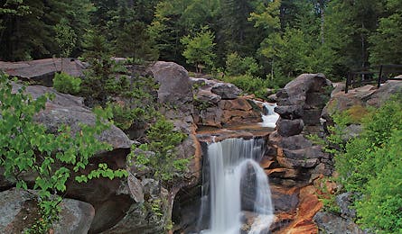
Screw Auger Falls (Tim Seaver)
The Details In 1994, Robert Stewart had an epiphany: create a hiking trail that linked his land, on Puzzle Mountain, to Grafton Notch State Park, six crow miles southeast. So he contacted the Appalachian Mountain Club, the Maine Bureau of Parks and Lands, and a few other players to figure out just how to make that happen. The idea morphed into the Grafton Loop Trail Coalition (GLTC). Mission: build a backpacking loop touring the backcountry’s most pristine reaches, and protect it from rampant home development. The coalition worked with private landholders to gain right-of-way via temporary access, easement, or outright purchase. By 2003, the loop’s 17-mile east portion had opened, and in 2007, the west side officially completed the circle. During the height of the housing bubble, things got a bit dicey with second homes popping up. “It was starting to threaten the backcountry quality of the area that we so desire,” says Sam Hodder, Maine State Director of the Trust for Public Land. And it could still become McMansion Central. “The falling housing market extended our window of opportunity to prevent further private development, but it’s still our biggest issue.” The Grafton Loop Trail passes through roughly 10 miles of private land that has yet to be protected, but wilderness designation could neutralize the looming threat.
The Hike The 42-mile circuit is New England’s newest and least-traveled path. It makes for an idyllic four-day hike, roller-coastering through spruce forests, along granite ledges, past fragile tundra, and over nine peaks. From Grafton Notch State Park, hike northbound on the Appalachian Trail for four miles on well-trod ground over rocky and exposed 3,680-foot West Baldpate, then 3,812-foot East Baldpate, where the Grafton Loop Trail branches off from the AT and begins a counterclockwise course. Camp at Lane, Stewart, and Sargent Brook campsites (tents only, no open fires). Hiking season is June through October (and is especially good after Labor Day, with crisp days, chilly nights, and no bugs). The sooner you go, the better. Says Hodder: “If we can demonstrate that the trail is attracting hikers and that part of the future of the new local economy is ecotourism, we can finish this job.” matc.org/glt1.htm
The Champions The GLTC consists of the Trust for Public Land
(tpl.org), which acquires rights; the Appalachian Mountain Club (outdoors.org), which builds and maintains trail; and the Mahoosuc Land Trust and Mahoosuc Initiative Partnership (mahoosucinfo.org), which “demonstrates commitment to local economy.”
The Way From Gorham, New Hampshire, head east on US 2 for 28 miles (crossing into Maine) to ME 26, then go 9.2 miles north.