Published June 21, 2013 01:16PM
Grand Traverses: Great Northern Traverse
Cross the top of Glacier National Park.
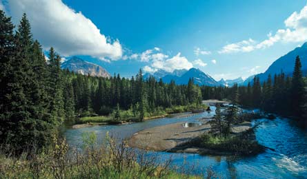
'9,000-foot summits loom beyond the Bell River Valley (Chuck Haney)'
Table of Contents | Pfiffner Traverse, CO | Roan Highlands, NC/TN | Sawtooth Ridge, WA | Ruby Crest, NV | Great Northern Traverse, MT | Sierra High Route, CA | Monroe Skyline, VT | Superstition Ridge, AZ | Guadalupe Ridge, NM/TX | Teton Crest Trail, WY | Greenstone Ridge, MI | Franconia Ridge, NH | Great Range, NY
Distance 58.6 miles
Gain 6,793 feet
Difficulty 5
Why it’s grand With this hike, it’s BACKPACKER readers’ favorite park, not a single range, that you’ll traverse. The six-day, relatively mellow route transects Glacier’s ice-carved backcountry on-trail, making it both epic and accessible. En route, pass lakes and creeks and hike over three high passes—with an average daily elevation gain of only 1,000 feet.
Do it Start at the Chief Mountain Customs trailhead near the Canadian border on the park’s east side, and stick with the water—for all but about 10 miles, you’ll be next to a creek or lake, courtesy of glaciers draining from above. The elevation gain on this route comes in two bursts, as you ascend Stoney Indian Pass, then Brown and Boulder Passes (biggest push: up 3,300 feet). Hike south on the Belly River Trail 6 miles to its junction with the Cosley Lake Cutoff Trail; follow that 2 miles to the Stoney Indian Pass Trail. Skirt icy blue Cosley and Glenns Lakes under the looming, 3,000-foot ship’s prow ridge of Pyramid Peak. Camp at Glenns, then chug up and over Stoney Indian Pass (mile 16.6) and down to the intersection with the Waterton Valley Trail (mile 20). Head north to Waterton Lake (camp here, mile 24.5), then take the Boulder Pass Trail up through rocky, tarn-dotted alpine terrain. Climb over 6,255-foot Brown Pass and 7,470-foot Boulder Pass to good camping at mile 36.2. Finally, cross several lush meadows along Upper and Lower Kintla Lakes. A car shuttle between trailheads is 96 miles (three hours) one-way over ultra-scenic Going-to-the-Sun Road.
Mountain goats can fit all four feet on a ledge measuring just 2 by 6 inches; look for them in tight spots. peakward: 9,000-foot summits loom beyond the belly river valley.
Contact (406) 888-7800; nps.gov/glac
Maps Trails Illustrated Glacier/Waterton Lakes ($12; natgeomaps.com)
Season June to September
Permits Required for overnight stays ($5/person/night); advance reservations available (apply by April 15; $30 processing fee; 406-888-7857)