Published May 6, 2008 04:07PM
Best Damn Weekend Ever: Acadia National Park
Avoid the crowds in Maine's Acadia National Park by skipping getting a jump on the season and hiking the park in the Spring. Stephen King country never looked so good.
'Acadia National Park, Maine Office of Tourism'
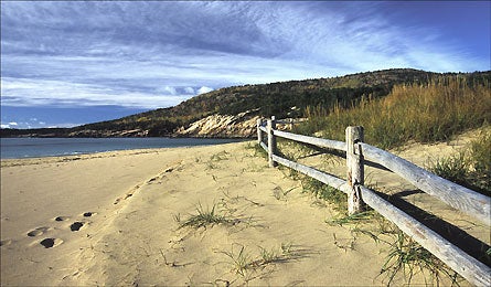
Here’s some statistical motivation: Of the two million people caravaning annually into Maine’s Acadia National Park, 1.8 million of them make the trip between June and September. The rest are mostly October leaf-peepers–which leaves deserted-island hiking opportunities in the spring (and winter, if bitter cold is your thing). April and May are special months at Acadia because of the solitude–you’ll see more herons and harbor seals than people–and the moderate weather.
Friday
Roll in by mid-afternoon to set up basecamp in Blackwoods Campground (Loop A is the most secluded); then drive to the Otter Point parking area and the Ocean Path Trail for a 5.8-mile evening trek. Hike 2.2 miles to Sand Beach, passing Thunder Hole, a rocky inlet that gets pummeled by waves, sending spray as high as 40 feet. Scan Sand Beach for lounging harbor seals, then cross Loop Road to climb the pink granite ledges of the Beehive Trail. You’ll grab iron rungs hammered into the rock to top out 505 feet above the coast. Dig the view? Continue south on Beehive to the Gorham Mountain Trail to summit Gorham Peak (520 feet) before descending to the Ocean Path and an easy return to Otter Point. It gets dark around 7:30 p.m. Pack a headlamp to be safe, or shorten the hike and backtrack from Sand Beach.
Saturday
Rise early for an 11-mile hike right from camp on the South Ridge Trail. Out of the gate, you’ll ascend 4.3 miles on sloping granite to Cadillac Mountain’s 1,532-foot summit. Cool fact to ponder while you enjoy the view: You’re standing atop the highest peak on the Atlantic coast north of Rio de Janeiro. From Cadillac, head east on the Notch Trail to 1,270-foot Dorr Mountain. As you lunch on the exposed summit, peer over the western edge to see rockslide debris released by a 3.8 earthquake in 2006. Descend east from the summit on the Dorr Mountain Ladder Trail (yes, some sections are actually ladders), which plunges down sheer rock walls to the Tarn, a shallow pond where great blue herons often fish. From there, bear south after one mile on The Gorge Trail, then head west 1.1 miles on the Cannon Brook Trail. Round back to camp on the South Ridge Trail.
Sunday
Pack plenty of water and snacks for an up-and-down 11.8-mile loop linking seven of the island’s bare granite peaks via a spiderweb of trails. Start from the Bubble Mountain parking lot and climb a steep 786 feet to South Bubble Mountain. Hike west to Sargent Mountain (1,373 feet) for 360-degree views of the area’s most calendar-worthy features: the Cranberry Isles, Porcupine Islands, and Somes Sound, the East coast’s only fjord. From there, summit Gilmore Peak (1,036 feet), Parkman Mountain (941 feet), and Bald Peak (974 feet), following cairns and blue hash marks. Resume hiking south and link Hadlock Brook, Sargent Mountain South Ridge, and Penobscot Mountain Trails to reach Penobscot Mountain’s 1,194-foot summit. Continue on to the Spring and Asticou Trails and the Jordan Pond House, a restaurant built in 1847 that opens in May each year (jordanpond.com). Grab a cup of hot tea (if anybody’s there) before tackling the last climb (750 feet) up Pemetic Mountain. Descend one final half-mile to the trailhead, knowing you’ve beaten the crowds by a matter of weeks.
Plan It
ADVERTISEMENT
The Way
From Portland, ME, take I-95 north to US Alt. 1 /ME 3. It’s three hours to the park’s main entrance.
Maps and Guides
Pair Hiking Acadia National Park by Dolores Kong and Dan Ring ($17; Falcon) with the Acadia National Park Map
($5; mapadventures.com).
Camping
Sites at Blackwater Campground are $10/night in April ($20/night, May to October).
Entrance Fee
April is free; May is $10 per car.