Published November 21, 2011 06:41PM
America's Best Backcountry Ski Tours
Upgrade your winter fun at these 8 beginner-friendly, expert-ready spots.
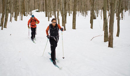
'Catamount Trail, Vermont (Photo by Corey Hendrickson)'
Stevens Pass, Washington
Hit reliable powder and easy-access slopes just an hour from Seattle. At Stevens Pass, east meets west as storms tracking off the Pacific collide with cold air pouring down from the Canadian Rockies. The result: a relatively stable maritime snowpack (characterized by heavy snowfall—450 inches annually—and mild temperatures) that lingers until May and consolidates in chutes, bowls, and glades. For beginning backcountry skiers, the prime terrain all lies within a straightforward hike from the parking lot on US 2, 78 miles northeast of Seattle. Skin 45 minutes to Skyline Ridge for gladed slopes that funnel 800 feet to an old logging road. More vert: Hike two additional miles to the summit above Skyline Lake, and link turns through an old-growth pine forest for a 1,000-foot descent. Big perk: All the trails off Skyline Ridge funnel back to the parking lot, where the perfect party wagon—your tailgate—awaits.
Contactstevenspass.com
Avalanche info (206) 526-6677; nwac.noaa.gov
Beartooth Pass, Montana
Shred spring corn on three moderate level, short-hike couloirs. Late May in the Beartooths is a time local skiers dream about: warmer temps stabilize the snowpack, and MT 212 opens, giving easy access to runs at Beartooth Pass. From the parking lot, 20 miles southwest of Red Lodge, hike 100 feet to reach the Gardner Headwall, a towering, snow-blasted face with three obvious chutes—the Hourglass, Main Chute, and East Chute. Each has butterflies-inducing 50-degree entrances, 1,000-foot drops, and football field-size snowfields. Hit ’em before noon (and boot-pack back to a car shuttle on the third switchback), then spend the afternoon exploring the steeper, tad-bit-longer Rock Creek Headwall, with twisty chutes and soaring views of Yellowstone’s rock spires. (Warning: If it gets too warm—above about 40°F—wet slides can occur. Be sure to take shovel, probe, and avalanche beacon—and know how to use them.)
Contact (406) 446-2103; fs.usda.gov/gallatin
Avalanche info (406) 587-6981; mtavalanche.com
Second Creek Drainage to Winter Park Resort, Colorado
Find snowy solitude just 70 miles west of Denver. With a base elevation of 11,307 feet and 1,200 acres of terrain ranging from gently sloping glades to 45-degree chutes—as well as a notoriously dicey snowpack—Berthoud Pass, on CO 40, is prime training ground for backcountry skiers. Sample a gape-worthy slice with views of the Continental Divide on a five-mile, all-day tour from the Second Creek Drainage to Winter Park Resort. From the Second Creek trailhead (at the second pullout on the left from the top of the pass, going west), hike 3.3 miles through mellow spruce forest to the under-construction Broome Hut. Spin a lap in the low-angle trees you just skinned through, then continue west to the obvious pass on the often-windblown plateau ahead of you. Stay skier’s left of the gorgeous but-slide-prone Second Creek Headwall, visible from any point on your trip, and beeline for the Panorama Lift tower glinting in the distance. Enter Winter Park Resort atop 12,060-foot Parsenn Bowl, then angle right, dropping 2,610 vertical feet down Parry’s Peek to Corona Way ski runs to the Mary Jane base area (and your car shuttle).
Contactberthoudpass.com
Avalanche info (303) 499-9650; avalanche.state.co.us
Utah Interconnect
Link backcountry stashes between six world-class resorts. You could spend seasons begging your more-experienced friends to teach you everything they know about backcountry skiing. Or you could sign up for the Utah Interconnect, a 25-mile guided tour that starts at Deer Valley Ski Resort and links Park City, Brighton, Solitude, Alta, and Snowbird ski areas. To maximize shred-time, this route incorporates 12 lifts to nix 16,000 feet of climbing. You’ll get real backcountry exposure as you target rock-lined ridges, yawning glades, and powder pockets all scouted by AMGA- and avalanche safety-certified guides who dispense tips and knowledge throughout the trip. Though this isn’t a true avalanche course (for that, hit avtraining. org for a list of schools), it’s a great in-the-field introduction to routefinding, terrain selection, and powder harvesting. Go with three or more friends and your guides will weave in even more tips on snow assessment and avalanche avoidance.
Contact $295/person (includes lunch, lift access, shuttle, and finisher’s pin), skiutah.com/interconnectAvalanche info (888) 999- 4019; utahavalanchecenter.org
Sugar Bowl to Squaw Valley, California
Follow the spine of the Sierra. Come winter, the Sierras—best-known for summer backpacking—are blanketed in 500 inches of snow and blessed with solitude. Target Tahoe’s High Route, a 12-mile, two-day tour that starts at the base of Sugar Bowl Ski Area (on I-80, 46 miles west of Reno); overnight at a rustic Sierra Club A-frame (sleeps 12, see contact below) and end at the base of Squaw Valley Resort. From Sugar Bowl’s base, skin 1,500 feet to the top of Mt. Lincoln on the Pacific Crest Trail; turn southeast, and follow an often-corniced ridgeline (hug the west side for safety) three miles to 8,683-foot-high Anderson Peak, with bowl and chute skiing off the north side. Take the ridge to Tinker Knob the next morning, with views of turquoise Lake Tahoe in the distance. Cruise 2.5 miles to Mountain Meadow Lake before linking turns down a steep, twisting gully that leads to the Solitude chairlift at the base of Squaw Valley.
Contact Reservations for the Benson Hut are $15 per person per night, (530) 426-3632.
Avalanche info (530) 587-3558; sierraavalanchecenter.org
Sawtooth Mountains, Idaho
Raise your game in no-crowd couloirs. With moderate, forested slopes that rise to near-vertical gullies, Idaho’s Sawtooths harbor the perfect terrain and conditions for skiers to incrementally test their backcountry skills. Do it on a three-day adventure that hits powdery glades, sun-soaked bowls, and a 1,500-footlong descent down a twisting couloir on 10,299-foot-high Mt. Heyburn. From the Redfish Lake gate, five miles south of Stanley on ID 75, ski 1.8 miles on flat road to the Bench Lakes trailhead. From here, head six rolling miles to the Bench Lakes Hut, hemmed in by the Sawtooths’ granite incisors ($175/night for five; svtrek. com). Spin laps on The Triangle, a 25- to 38-degree glade that loads up with wind-protected powder. Day two: Skin one mile from the hut to the wide-open bowl above Bench Lake 5. Day three: From the base of Heyburn, boot-pack up the right side of the gully to top out 1,500 feet above Bench Lake 5. Snaking between Heyburn’s twin summits, the couloir tips to 55 degrees before doglegging around a granite finger and then mellowing. Link turns to an apron that terminates at Bench Lake 5.
Contact (208) 737-3200; fs.usda.gov/sawtooth
Avalanche info (208) 622-8027; sawtoothavalanche.com
Catamount Trail from Bolton Valley Nordic Center to the Trapp Family Lodge, Vermont
Ski the East’s most untamed tour. The 300-mile-long Catamount Trail began as a grad student’s dream to link two cross-country ski resorts through some of New England’s wildest backcountry. Enjoy the fruits of his labor on this 9.4-mile section that goes from the Bolton Valley Nordic Center to the Trapp Family Lodge. You’ll climb 1,300 feet before dropping nearly double that through open, often powder-choked spruce forest. The first 6.5 miles are the most rugged, crossing multiple creeks and climbing ungroomed switchbacks. Routefinding can be tricky; travel in groups (for navigation help and safety) and follow CT blazes. After the Raven’s Wind intersection (mile 2.1), skirt the east shoulder of Bolton Mountain, a ridge running east from the peak. Lunch in an open area called Windy Ridge before dropping to the north on a series of long, downhill switchbacks. After several switchbacks—and a few stream crossings— the trail drops steeply to another crossing with open water. Parallel the stream until you come to a bridge and a decrepit logging camp (mile 5.4). From Nebraska Valley Road parking lot (mile 6.5), walk 100 yards to Old County Road. Turn right, rejoin the trail through a cluster of seasonal homes, and link to the groomed trail network of the Trapp Family Lodge.
Contactcatamounttrail.org
Avalanche info no forecast center
Mt. Marcy, New York
Ski from the summit of the state’s highest peak. Here’s a pairing all backcountry skiers and riders should dream about: low avalanche risk and huge vertical drops. Mt. Marcy, the highest peak in New York at 5,344 feet, is tied with Whiteface Mountain (a nearby ski resort) for the longest vertical drop in the East—3,166 feet from the summit. The route’s avalanche risk stays low thanks to dense woods and low slope angle on all but the icy, wind-hammered summit cone. To ski it in a day, skin the twisty Van Hoevenburg trail 7.4 miles to Marcy’s bald summit. Gaze across snow-dusted hardwoods that stretch to the Green Mountains. When you’re ready to shred, close your eyes, point, and spin a 360: Any aspect off the summit will have unobstructed snowfields, but locals claim the best snow and longest lines lie on the north face. Pick your way down powder stashes hidden in snow-choked ravines (bearing right at the bottom to rejoin with the Van Hoevenburg Trail). Daredevil? Make like a luger and retreat the way you came up—on the narrow Van Hoevenburg.
Contactadk.org
Avalanche info no forecast center