Updated July 11, 2025 11:48AM
Orienteering: The Hiker’s Sport
With map and compass in hand, world-class navigators take to the Estonian forest to compete at the World Orienteering Championships. Who has what it takes to complete this race?
'Courtesy of Greg Ahlswede'
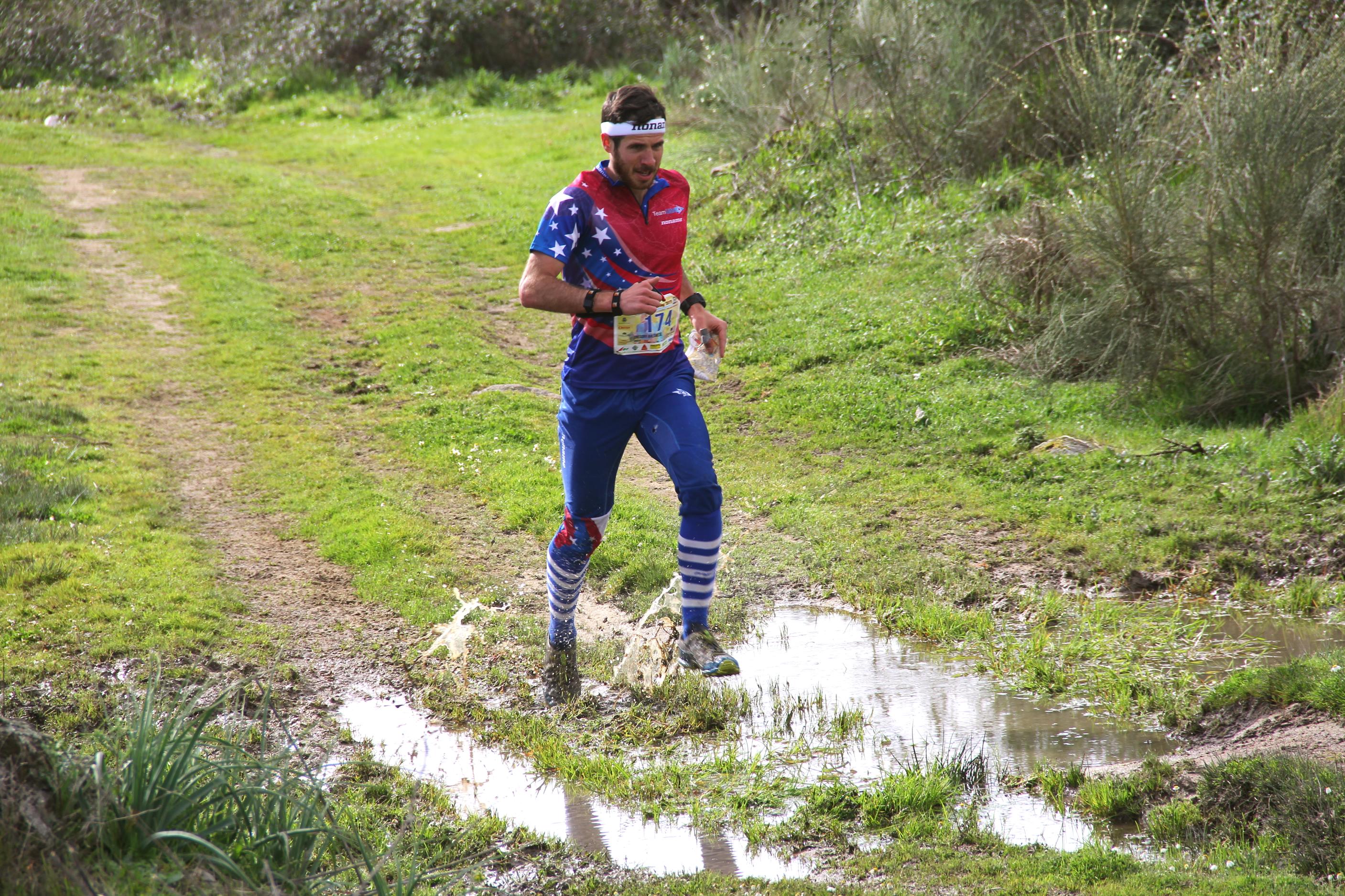
The energy in the forest is palpable as USA competitor Greg Ahlswede walks up to the start line. Around him, professional navigators from across the globe are preparing their bodies and minds for battle. Like everyone else here, Ahlswede has no idea in which direction he is about to run, but he plans to do it very, very fast.
It’s July 4, the fifth day of the 2017 World Orienteering Championships, the biggest and baddest competition series in navigation racing. Against Ahlswede are a slew of professional hikers and backpackers with a keen sense of direction and speed. It’s a sport for the map lover, the trail lover, the endurance racer. For Ahlswede, this sport is everything.
This year, the race brings competitors to Tartu, Estonia, an exceptionally hilly, low-lying forest blanketed in moss and dense in vegetation. Due to its intricate terrain and low visibility, the Estonian forest offers what orienteers call “very low runnability.”
Race orienteering, the activity of speed-navigating through unfamiliar terrain with just a map and compass, may seem like a new trend in the states, comparable to mud runs and obstacle courses. But in Europe, this century-old, Olympic-recognized sport is serious business, with origins in Sweden as a military training exercise.
Though it’s growing in popularity, race orienteering in the United States took much longer to gain a following. Up until the 1960’s, it was generally considered as a mere Boy Scouts game or practice activity for backpackers. Americans’ lack of success has mostly been attributed to our very short history with the sport. But as the 2016 North American long and classic distance champion, as well as the 2016 US Orienteer of the year, Ahlswede is one of America’s strongest competitors. Today is the day of the long distance race. While he’s competed in other events for days now, this one is really what he’s here for.
ADVERTISEMENT
In a few moments, a volunteer will hand Ahlswede a topographic map and a compass, both of which he will be seeing for the first time. His goal will be to use both tools to navigate from point A to point B on the map, zig-zagging through every marked control point in chronological order along the way. Because the start times are staggered to allow each racer room to navigate their own path, Ahlswede will be running against himself, having no idea how he ranks until everything is said and done.
As soon as the map makes contact with his hand, Ahlswede takes off into the remote forest, alone, at a dead sprint. He likes to compare speed orienteering to the art of getting lost. “You are always, at some level, lost,” he says. When you think you’ve messed up, you just “[s]top running. Look around you. Look behind you. Get back in contact with the map and relate your surroundings to what the map is telling you…then you get running again.”
It’s a mental game as much as it is physical. During training, Ahlswede almost always has a map in his hand. “We do something called overspeed training, which basically means you’re moving faster than your race pace. The goal is to train your mind to read the landscape as fast as your body can run. Imagine you’re trying to process all of your surroundings while driving a car on the highway.”
ADVERTISEMENT
In the next 2 hours and 27 minutes, Ahlswede will face swamps, mosquitoes, grueling climbs, slippery downhills, massive valleys and uncertain terrain. Because there is no set route or trail for navigation races, the term “long-distance” is somewhat ambiguous. In a straight line, the World Championships long distance map covers a distance of approximately 17 kilometers. By the time he crosses the finish line, Ahlswede will have run over 22 kilometers, roughly the distance of a half marathon.
“It may not seem like a lot, 22 kilometers in 2 and a half hours, but that course was dense!” he says. “Really intricate.” When asked about his favorite terrain for racing, Ahlswede always mentions the dense stuff. “The more intricate, the better.”
And at the 2017 long-distance world championships, his preferences pay off. Ahlswede placed 47 in the race, the highest American finish since 1989.
After a day of rest, Ahlswede will next take on the middle-distance relay with his fellow Americans, one of the only races with a mass start. On “go,” a stampede of world-class navigators take off at a dead sprint, with map and compass in hand. “Everybody is sprinting a 4:50 minute/mile through this thick forest.” He says.
“It’s insane. It’s amazing…I love it.”
Getting involved:
ADVERTISEMENT
Greg Ahlswede is a world-class athlete and an American orienteering coach with goals to create a domestic training center for elite USA orienteers. He fell in love with the sport at age 8, after his father brought him and his brother to a local race in Philadelphia, Pennsylvania.
Orienteering clubs are located all across America and offer training, support and information for people of all ages and skill levels. For those interested in navigation racing, Ahlswede recommends visiting Orienteering USA’s website, where you can find your own local club and get involved.
Want to brush up on your navigation skills? Check out BACKPACKER’s Backcountry Navigation Course.