Updated July 3, 2025 12:03PM
Master Class: Off-Trail Hiking
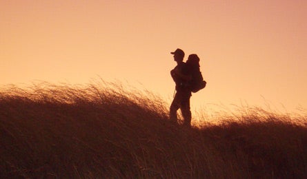
Discover secret campsites and total solitude with this expert guide to safely navigating untracked wilderness.
'Photo by Alanna Baumert'
Interested in improving your navigation skills? Join Backpacker’s Backcountry Navigation or Basic Map and Compass Skills online course today.
1. Core Knowledge: Start Slowly
If you’ve never strayed from the beaten path, begin by exploring easy terrain with a dominant feature to anchor you, Donohue suggests. Examples: subalpine meadows, wooded areas with a prominent creek, or low valleys between two peaks. You can also explore with one of the tried-and-true methods below. Either way, track progress on a map (7.5-minute topos, on which 1 inch represents 2,000 feet, afford the best terrain detail). Do a slingshot. Use an established campsite as home base and complete several out-and-back dayhikes. Venture farther and try new directions as you gain confidence. Follow the leader. Trace a creek or game trail (a faint path worn by wildlife) out and back. Caution: Animals may lead you into steep or otherwise human-unfriendly terrain.
Connect the dots. Link two familiar trails via an off-trail route. This is a good way to test your map skills without straying too far from an established path.
Negotiate Hazards
Safely travel through these tricky terrain features.
ADVERTISEMENT
Blowdown
Storms and wildfires can leave behind an obstacle course of downed trees. Tap or shake a trunk to check for stability before crawling over or under it; use trekking poles for balance and watch for eye-poking branches. If the blowdown is massive, it can be faster to hike around it. Check your map for an alternate route.
Talus/scree/boulders
Look for and follow game trails over the rocks. Stay nimble, ready to leap away if a rock shifts underfoot. Test the stability of boulders (with one foot or a trekking pole) before putting your full weight on them. Always move from one balanced position to the next.
Sidehill slope
Go slowly, leaning into the hillside and pointing your downhill foot outward to avoid rolling your ankle. Use trekking poles for extra support: Shorten the one on the uphill side and lengthen the one on the downhill.
ADVERTISEMENT
Thick alder or other brush
Put all your gear inside your pack and tighten the buckles so that nothing gets snagged or lost. Pick your line before going in and keep an eye and ear out for bees and bears.
Dense forest
You may not be able to see the sun or other features to guide you, so use a compass to follow a single bearing.
Lighten Up
“Heavier loads are generally more unstable, and off-trail travel is all about stability,” Donohue says. A lighter pack leads to better balance, more agility, and increased comfort. Keep it under 25 percent of your body weight.
ADVERTISEMENT
2. Next Level: Sharpen Your Navigation Skills
GPS units are great—until the batteries die or satellite reception fails (as it can in thick forests or narrow canyons). Learn to trust your map-reading skills before venturing far afield.
- Turn on your GPS and stash it in your pack, out of sight, as a backup.
- Fold your map so that just your current location and destination are displayed.
- Orient the map in your hand so that it shows the perspective you’re seeing.
- Start hiking, relying solely on the topo map to guide you. Estimate your speed and plot your course, then check where you think you are against the GPS.
- The more you practice, the less you should depend on the GPS. You’ll be better at estimating mileage and speed over varied terrain and choosing the best lines on a map, even if you’ve never been to the location.
Plot Your Route on a Map
Want to hike to a remote lake, summit, or valley? Study your topo map pretrip to identify the easiest route to your destination.
» Remember that the shortest line between points isn’t always best, Donohue says. Traveling farther on level terrain is often faster than cutting through thick brush (A) or hauling gear up a steep slope (B). Hike along a contour line (C) to avoid unnecessary ups and downs, and use moderate, open ridges (D) to gain elevation. Peakbagging? The best routes often take ridges to passes (E) to the summit.
» “Get as much beta as you can beforehand,” Donohue advises. Visit online forums or talk with guides or rangers who have hiked in the area recently. They can tell you about current conditions and hazards not on the map.
ADVERTISEMENT
» Be realistic about mileage goals: Five miles or fewer per day is a good bet.
Avoid Common Mistakes
Beginners Damaging fragile terrain The fix Disperse your impact: Don’t walk single file if you’re in a group (exception: crypto). Step on rocks, sand, gravel, snow, and other durable surfaces before trampling vegetation. Bonus: These surfaces provide easier passage than fighting your way through fragile wetlands or brush.
Intermediates Overestimating your speed The fix “Whatever timeframe you expect to do your hike in, double it,” Donohue says. It’s not uncommon to travel less than 1 mph in difficult terrain, he cautions.
Advanced Taking shortcuts The fix Whether it’s crossing a river at a dangerous spot or scrambling up a cliff that you can’t safely descend, the increased risk isn’t always worth the time saved. “Standard precautions apply no matter how experienced you are,” Donohue says. Take the few extra minutes to look at your map and scout the safest passage.
ADVERTISEMENT
3. Advanced
Micro-navigate
Routefinding isn’t over after you identify the path of least resistance on your map. Once you’re in the field, refine your planned route by scouting the terrain from a distance (a mile or two at a time), a process Donohue calls micro-navigation. Look around (from a vantage point with binoculars, if possible) and double-check your decisions about which side of a valley to descend, where to enter the brush, and which line to take across a sidehill slope; sketch adjustments on your topo. Be on the lookout for challenges that don’t appear on your map, like lingering snowfields, cliffs that fall between contour lines, or wildlife you’ll have to detour around (such as a herd of bison).
Navigate Around Obstacles
On a map, the route to your intended destination can look like a straight shot—until you run into a blowdown, marsh, or cliff in your path. To get around the problem without losing your way, use your compass to sight a prominent object (like a tree or rock formation or peak) that is beyond the obstacle and lies on your original bearing. Travel to that object by the easiest path, then continue hiking on your intended bearing.
Find Water
When you’re off trail for days, finding water is essential. Here’s how to do it in the driest places.
ADVERTISEMENT
Alpine
No snow or streams? Bugs, birds, and other wildlife like to hang out near water. Use binoculars to scout for wildlife or game trails that may lead to a spring.
Desert
Cottonwood trees, willow, or other deciduous vegetation signal water nearby (but you might have to dig for it).
Canyon
Scout into the canyon with binoculars, looking for potholes full of water. A full pothole indicates there are probably other deep pools to draw from.
ADVERTISEMENT
Know When to Bail
The consequences of running into trouble can be more severe off-trail. Seriously reconsider your plans if:
- You’re very fatigued and far short of your intended destination. Set up camp for the night and reevaluate your travel plan.
- You encounter conditions you’re not prepared for, such as high water or steep terrain. Never attempt to press on without the proper equipment and knowledge to handle the situation.
- Dangerous weather is approaching. Turn around and/or find a safe place to set up camp and ride it out.
- You get injured or sick. Even minor issues can quickly worsen and leave you stranded if you push on.