Updated July 7, 2025 09:46PM
If you buy through our links, we may earn an affiliate commission. This supports our mission to get more people active and outside.Learn about Outside Online's affiliate link policy
The Perfect Weekend Backpacking Trip: 21 Tips for a Better Hike
Work! Altitude! Traffic! Sometimes it seems like the universe is conspiring against your hiking plans. Here's how to subdue those hazards and 18 other trip killers to keep your weekends sacred.
'Daniel Jansen / @Detswit_Photography /'

The Problem: I’m not acclimatized.
Maybe your body isn’t used to high altitude, or maybe there’s still a lot of snow clogging up the high passes. Either way, set your GPS for a rewarding trip that never tops 8,000 feet.
Boulder Mail Trail, Grand Staircase-Escalante National Monument, UT
When you can’t go high, go low. Once a 19th-century mail route between Boulder and Escalante, the 15.5-mile Mail Trail hops across a series of juniper-covered, 6,700-foot plateaus in the desert, dips into a series of slickrock canyons, ponderosa forests, and spring-fed creeks—and it comes into season when the high country is still snowed in. From Boulder, drop into the first of those canyons, slickrock-lined Sand Creek near mile 2.9. Cross the cedar-covered plateau to the telephone wire installed in the early 1900s and follow it to the rim of Death Hollow, which supposedly gets its name from the unfortunate fate of a mail delivery mule. Head downstream and consider walking in the typically shallow water to avoid the poison ivy prevalent in certain spots before climbing back out after mile 6.9. Camp in Mamie Canyon before mile 9 and make a side trip .8 mile southeast of camp to walk beneath a natural bridge and into a stone amphitheater. The next day, ascend out of Mamie and continue across Antone Flat to Escalante at mile 15.5.
ADVERTISEMENT
Trailhead Boulder Airstrip (37.8839, -111.4645) Shuttle 37.7679, -111.5780 Road 2WD Season September to May Permits Required; pick up at the Anasazi State Park Museum in Boulder or the Escalante Interagency Visitor Center in Escalante; no reservations necessary.
Also Try: Clingmans Dome-Deep Creek Loop, Great Smoky Mountains National Park, TN/NC
Reach the park’s high point—still only 6,643 feet—on a three-night, 35.4-mile loop to the summit. Take the Noland Divide Trail to camp at Bald Creek (mile 8.6), the Appalachian Trail to Mt. Collins Shelter (mile 18.9), and link up the AT, Fork Ridge, and Deep Creek Trails to camp at Bryson Place (mile 28.7). To exit, follow Deep Creek itself to the trailhead.
—Ryan Wichelns
The Problem: The forecast is appalling.
You can’t change the weather—or predict it when you plan your trip—but that doesn’t mean you have to choose between sleeping in a wet tent and staying home.
• Before you go Check that your seams and fly are in good condition. Ensure guylines are attached and at least 10 feet long.
• Site right Avoid places where water might run or pool, and be wary of lone trees, exposed areas, or other lightning magnets.
• Use natural shelter Pitch your tent under tree cover and then move it into the site you selected.
• Pitch perfectly No tree cover? Cinch the hood on your shell then move purposefully and efficiently to set up your shelter without having to make too many adjustments. Tension all guylines so water can’t pool on top of your fly.
• Mop up Using a bandana or pack towel, sponge the moisture off your tent floor and wring it out in the vestibule.
• Just breathe Pop open all your vents; cross ventilation is your new best friend.

ADVERTISEMENT
The Problem: I can’t sleep.
Lots of things can steal your slumber. What’s got you?
What was that noise?
Put in some ear plugs. You can’t fear each little rustle if you can’t hear it.
My arm/hips/back hurts.
Pick up an inflatable mattress that’s at least 2 inches thick. Blow it up as firm as you can, lie on it, and release some air out of the valve until it’s comfortably squishy but not so soft your hips hit the ground. Side-sleepers usually require a little more firmness.
ADVERTISEMENT
I hate sleeping on the ground.
Get thee a hammock.

The Problem: Everything’s on fire.
Climate change and ongoing droughts have conspired to turn timber into tinder. Ditch the risk by camping in places where past wildfire already consumed the fuel. —R.W.
Kalmiopsis Rim Loop, Rogue River-Siskiyou National Forest, OR
A maze of rocky ridgelines and confusing drainages, the remote Kalmiopsis Wilderness seems forgotten by everything but lightning. This 20.2-mile loop encircles the Baldface Creek drainage on spines ravaged by fires in 2002 and 2005, leaving behind the charred husks of sugar pines, views of southern Oregon from rocky ridges, and clear alpine lakes. Start along the Kalmiopsis Rim Trail (1124), which was used as a fire line during the 2015 Buckskin Fire: Trees were felled, clearings were opened, and bulldozers trampled the area in an effort to stop the flames. It’s an unsightly scar, but it shows its upshot when you see the views. Follow the ridgeline above glacier-carved Rough and Ready Lakes at mile 6.9, which hold good campsites on their southeastern side. Beyond the lakes, the trail drops below the ridgeline through Doe Gap (pick up the North Fork Smith River Trail 1233 here) before finally starting a 2,000-foot descent via the Baldface Creek Trail (1215) to the former McKee Cabin at mile 15.3. Climb again over Biscuit Hill and follow the trail then road back to the trailhead.
Trailhead Buckskin Peak (42.0446, -123.8496) Road 2WD Season May to October Permits None
ADVERTISEMENT
Also Try: Salmo-Priest Loop, Salmo-Priest Wilderness, WA/ID
Thanks to wildfires, views of the Selkirk Mountains are constant from atop the Shedroof Divide on this 20-mile loop. From Road 2220 (Salmo Basin trailhead), take Trail 506 to the South Salmo River then climb Snowy Top Pass (mile 10.8; camp below the pass). Turn south on Trail 530, side-trip up 7,572-foot Snowy Top Mountain, then connect Trails 512 and 535 back to your car.

The Problem: I can’t stand camping food.
Ditch the stroganoff sodium bomb and go for something with real taste. These recipes bring flavor, freshness, and moderate prep to the only weekend backpacking menu you’ll ever need. By Alisha McDarris
Saturday Lunch: Loaded Salad Wrap
Prep this veggie-heavy lunch before you hit the trail. Makes 2 servings
- 1 cup fresh kale, chopped
- 6 Tbsp. shelled edamame
- 6 Tbsp. grated carrot
- 6 Tbsp. grated beet
- 2 Tbsp. pepitas
- 1 avocado, mashed
- Juice of 1 lime
- ½ tsp. garlic powder
- ½ tsp. cumin
- Salt and pepper to taste
- 2 whole-wheat tortillas
At home: Toss kale, edamame, carrot, beet, and pepitas in a bowl. In a separate bowl, combine the avocado, lime juice, garlic powder, cumin, salt and pepper, and mash together. Transfer the avocado mixture to the kale mixture and toss to coat. Wrap burrito-style in a tortilla. Store in a zip-top bag until ready to eat.
Weight 6 oz. Protein 11 g Calories 500
ADVERTISEMENT
Saturday Dinner: Peanut Butter Noodles
Dress your ramen in flavor. Makes 1 serving
- 1 package ramen, seasoning packet discarded
- 2 tsp. dried broccoli
- 1 Tbsp. chopped dried mushroom
- 2 tsp. dried carrot
- 1 vegetable bouillon cube
- ¼ tsp. garlic powder
- ¼ tsp. onion powder
- ¼ tsp. ground ginger
- 4 Tbsp. peanut butter powder
- ¼ tsp. crushed red pepper
- 1 tsp. soy sauce
- 2 Tbsp. roasted peanuts
- 1 ½ cups water
- 1 pouch cooked chicken (optional)
At home: Combine the dry ingredients (excluding peanuts)in a zip-top bag. Place soy sauce in a leak-proof container and pack peanuts separately.
In camp: Bring 1½ cups water to a boil and add in contents of the ramen mixture along with the soy sauce. Cook for 3 to 5 minutes or until ramen reaches desired consistency. Remove from heat and add peanuts and chicken (if using).
Weight 5 oz. Protein 23 g Calories 557 (chicken adds 200 cal. and 24 g of protein)
ADVERTISEMENT
Sunday Breakfast: The Fluffiest Backcountry Flapjacks
Start your day off right with these easy-to-prepare pancakes and a non-stick skillet. Makes 2 servings
- ¾ cup whole-wheat flour
- 1 tsp. baking powder
- ½ tsp. salt
- 2 Tbsp. coconut milk powder
- 2 tsp. sugar
- 1 ½ tsp. oil
- ½ tsp. vanilla
- ¾ cup water
At home: Combine the flour, baking powder, salt, coconut milk powder, and sugar in a zip-top bag. Put oil and vanilla in a leak-proof container.
In camp: Empty the dry mix into a bowl. Add the oil, vanilla, and water and stir to combine. The batter should be loose but not runny, like muffin batter. Don’t overmix; some lumps are OK. Heat your non-stick skillet over medium heat and scoop ¼ cup of the batter into the pan at a time. Cook until the edges begin to dry out and the pancake easily slides off the pan, about 3-4 minutes, then flip and cook the other side until cooked through, about 2-3 more minutes. Enjoy as-is or top with fruit or syrup.
Weight 3.4 oz Protein 8 g Calories 312
ADVERTISEMENT
Sunday Lunch: Gourmet PB&J
This spin on the backpacking staple is more refined and nutritious. Make it ahead and it will smash into perfection while you hike. Makes 2 servings
- 4 Tbsp. peanut butter
- 2 Tbsp. raspberry jam
- ½ tsp. chia seeds
- 2 tsp. cashew pieces
- Salt to taste
- 2 blueberry bagels
- 1 apple, sliced into ¼-inch-thick wedges
At home: In a bowl, stir together the peanut butter, jam, chia seeds, cashew pieces and salt. Spread the mixture on both halves of a blueberry bagel and top one half with the apple slices. Sandwich the bagel slices together and store in a zip-top bag.
Weight 7.3 oz. Protein 18 g Calories 558
ADVERTISEMENT
The Problem: My kids won’t come.
Flip the script by making it seem like they’re in charge. Deploy these tricks from Annie Holmes, an instructor for the Colorado Outward Bound School. Pair with a low-mileage, high-reward outing. By Corey Buhay
The Commandments of Hiking With Children
I. Cede some power. “What do you want to do this weekend? What kind of trail would you get excited about?”
II. Make it a group thing. “Want to invite some friends along?”
III. Check in with them. “Why don’t you want to go? Is there anything you’re worried about happening?”
IV. Quell insecurities. “We’ll only go as far as you want to go. If we only get halfway there, we’ll set a different goal—no big deal. You’re the boss.”
V. Be honest. “I really want to go on this hike. I know you’re not completely psyched, but it’s really important to me, and it would mean a lot to me to have you there. What can we do to make this fun?”
VI. Screw it. Just bribe ’em. “There’s this incredible ice cream parlor on the way home. What if we just do a short hike then grab a waffle cone?”

ADVERTISEMENT
Best Hikes to Take With Kids
Dunefield, White Sands National Park, NM
Like sleeping in a giant, glistening sandbox, camping in the backcountry of White Sands feels like staying at a playground. A short 1-plus mile hike in to one of a handful of backcountry campsites (BYO water) along a loop trail leaves backpackers surrounded by the starch-white gypsum dunes, isolated from other campers. Go barefoot and ride snow sleds off the slopes near camp, but when the lights shut off and the gates close, get ready for a show. From the dunes surrounding camp, watch for other hikers emerging from their own private hideaways for a front row seat at a sunset unlike anything you’d see elsewhere: The white sand takes on the color of the sky and turns the park into a 360-degree light show.
Trailhead Backcountry Camping Loop (32.8099, -106.2647) Road 2WD Season Year-round Permits Required; $3/person, first-come, first-served; pick up at the entrance booth day-of. Entrance fee $25 per vehicle

Ebeoy’s Landing, Ebey’s Landing National Historical Reserve, WA
Don’t tell your kids this is a hike. Tell them it’s a bird-sighting, wave-splashing, volcano-viewing, toes-in-the-sand romp. Right from the parking lot, Mt. Baker’s marbled massif looms in the east, and the Olympic Range spreads out to the south. Start a 4.6-mile loop on the Prairie Ridge Trail, passing the historic Jacob Ebey house to a junction at mile .7. Make a right and climb a hill to views of the beach below. Traverse the top of the bluff, in and out of windblown trees and wildflowers like perennial wooly vetch, then descend slowly toward a lagoon, a year-round paradise for shorebirds, waterfoul, and eagles. Switchback down to the beach and head south through the sand, enjoying the waves, until you reach the Ebey’s Landing Parking Lot at mile 3.6. Climb back up the bluff back to the Prairie Ridge Trail and head back to your car at mile 4.6.
Trailhead Prairie Overlook (48.2046, -122.7068) Road 2WD Season Year-round Permits None
ADVERTISEMENT
Also Try: Turkey Creek Trail, Big Thicket National Preserve, TX
A maze of different ecosystems, flora, and fauna, this 15-mile section of Big Thicket National Preserve looks like the set of Jurassic Park. Take the Turkey Creek Trail with an optional foray along the Pitcher Plant Trail (mile 2.8). Sleep among hardwood pines at Sandhill Loop (after mile 12.7).
Panther Creek, Panther Creek Recreation Area, GA
Small waterfalls, giant hardwoods, and mossy boulders are nice, but hardly the main attraction along this 6.4-mile out-and-back in Chattahoochee National Forest. Relax on the sandy shoreline at mile 3.2 below cascading Panther Creek Falls while the kids splash in the cool stream water (observe LNT).
The Problem: I, uh, don’t want my kids to come.
It can feel shameful to tell kids you’re going on a fun trip without them. Try this script from mountaineer Hilaree Nelson, who has established first ascents around the world and is raising two boys, ages 10 and 12.
ADVERTISEMENT
“In a couple weeks I’m going on a trip to [destination] with [partner]. I know you want to come, but this is something I have to do without you. Spending time in the mountains is something I really love, and doing things I love helps me learn and grow and be a better mom to you guys. I’ll be back before you know it, and when I do, you and I will plan a trip together to [place your kid’s been wanting to camp]. I love you so much, and I can’t wait to get back and tell you all about my trip.”

The Problem: The first campsite is too far.
Leaving after work on Friday? These campsites are shallow enough that you can make camp before dark. —R.W.
Kelsey-Hog Hill-Dorsey Trails LoopSycamore Canyon Wilderness, AZ
Get a jump on a long weekend full of miles-wide views of one of the largest red rock canyon systems in Arizona by taking a 30-minute hike into camp on Friday night. Descend steeply from the trailhead for a half mile to Kelsey Spring, camping between there and Babe Hole Spring at mile 1. Get your first view of the canyon to the west the next morning, just below the canyon rim, as you weave in and out of thick ponderosa pine, oak, and juniper trees. Loop the Kelsey and Hog Hill Trails, passing an old dilapidated cabin after mile 5.4. Follow the Dorsey Trail back west to the Kelsey Trail, camping in a clearing just downslope from Dorsey Spring at mile 9.4, and hike north the next morning to link up with your car for 12.8 total miles.
Trailhead Kelsey (35.0745, -111.9297) Road high-clearance 4WD Season April to November Permits None
ADVERTISEMENT
Also Try: Isolation Mountain Dry River Wilderness, NH
The 20.8-mile hike up the Rocky Branch Trail and over the northern Montalban Range, including 4,003-foot Mt. Isolation, yields solitude and views of the Presidentials. Friday-night bonus: Basecamp at Rocky Branch Shelter #1 is just 2 miles in.
The Problem: It’s too f@%#!ng hot!

Make like a lizard to rest during the hot part of the day and shelter in shade.
By Matt Vasilogambros
Dress the Part
Wear sunscreen and light-colored, loose-fitting, sweat-wicking, UV-protective shirts. Opt for long sleeves and pants to cover more skin. Keep the sun off your face with a wide-brimmed hat and a neck gaiter. In exposed desert, an umbrella with a reflective top can create deep shade.
Hike Strategically
Rise early, hike late, and plan on a 2-hour lunchtime siesta. Only rest in shade, even if it means scurrying under some desert brush to find it. To avoid feet swelling and blisters, take your shoes and socks off during long breaks and elevate your feet for 10 minutes.
Site Your Shelter
A tent in the sun captures heat like a greenhouse and UV rays are hard on the rain fly. If you’re leaving camp without your tent, put it in a shady spot or take it down.
Sleep Out
Invite the breeze by ditching the fly or the tent.

ADVERTISEMENT
The Problem: Critters stole my food.
Menu compromised? Forage for a new one. Unlike many wild edibles, cattails are easy to identify, grow in wetlands throughout the U.S. and Canada, and provide a year-round food source. By Corey Buhay
Early Spring
Clip new shoots when they’re 4 to 16 inches high, and eat the tender, cucumber-flavored white bits. Crunch on them raw or steam them for an asparagus substitute.
Spring
Pluck green flowerheads, discard the leaves, and boil until tender (15 to 20 minutes). Then, slather with butter, salt, and pepper if you got ‘em. Boom: backcountry corn-on-the-cob.
Early Summer
Shake the yellow pollen into a bag. Pick out any plant fibers, and add water for a protein-rich porridge.
Fall and Winter
Dig through the mud around the roots with your hands. You can eat the new growth (small, pale, lateral nubs) raw.
Positively ID
First, make sure the leaves wrap a cylindrical, leek-like stem. If they fan out, it’s an iris (toxic). Avoid stands next to roads; cattails absorb chemicals

ADVERTISEMENT
The Problem: Every good spot is busy.
It’s a common lament. But in popular places, look for quiet trails right in the shadow of marquee neighbors. —R.W.
Snowmass-Willow Lake Loop, Maroon Bells-Snowmass Wilderness, CO
A sure sign of a crowded trailhead is mandatory shuttle buses; you’ll see them kicking up dust on the road to the most photographed spot in the state, Maroon Lake. Instead, skip the packed Maroon Bells trailhead (see page 38) and the full Colorado-classic Four Pass Loop in favor of its slightly shorter next-door neighbor with the same big-mountain views and picturesque alpine lakes. Begin the 22.9-mile loop on the less-visited west side of the Maroon-Snowmass Trail, following Snowmass Creek up the valley, through numerous clearings with views into the steep-sided and rocky Elk Range. Pass Snowmass Lake at mile 7.8, tucked under the east face of 14,098-foot Snowmass Mountain before joining a short section of the Four Pass Loop and climbing along the Buckskin Pass Trail east into the alpine, cresting the 12,462-foot saddle at mile 11.7 and taking in views of the Maroon Bells to the east. Leave the popular route shortly after and climb up and over Willow Pass before descending to Willow Lake to camp at mile 14.6, which offers vestibule-door views down the U-shaped Willow Creek Valley. Next day, climb up and over a final pass on the East Snowmass Trail before descending along Snowmass Creek back to the trailhead at mile 22.9.
Trailhead Maroon/Snowmass (39.2005, -106.9904) Road 2WD Season June to early October Permits Required; self-register at the trailhead
ADVERTISEMENT
Also Try: Mt. Hoffmann,Yosemite National Park, CA
Look down on Half Dome and Clouds Rest from the smaller—but no less spectacular—summit of Mt. Hoffmann on a 5.6-mile out-and-back from May Lake Road. Camp at May Lake (mile 1.2) to make it an overnight.
Enchanted Valley, Olympic National Park, WA
Glacier views and hundred-foot waterfalls give this valley in Olympic National Park a high-alps air—and other parts of the park draw more visitors. Start the 30-mile out-and-back on the East Fork Quinault River Trail from the Graves Creek trailhead.
The Problem: I’m not ready to go.
It shouldn’t take you more than 10 minutes to pack your stuff and go. Good prep is the ticket.
- Store all your gear in bins labeled by type, like Sleep and Kitchen.
- Moving bin to bin, grab all the equipment you need.
- Throw your clothes in a stuffsack.
- Cram all of it into your pack.
- Bring a menu to the supermarket.
- Dry your gear when you return.
- Return it to the proper bins (or you won’t be ready next time).

ADVERTISEMENT
The Problem: I lost my keys!
Here’s how our Twitter followers hang onto their ride home. Best bet: Bring a spare.
Where do you store your keys?
76.4%: In my pack
17.1%: In my pocket
3.6%: I mostly just lose them.
2.9%: I give them to my trip partner.

ADVERTISEMENT
Problem: The roads are worse than I thought.
Dirt roads in the backcountry have a habit of transforming into impromptu obstacle courses that can spell trouble for vehicles with less than 6 inches of ground clearance. Use these tips to help you reach the trailhead in once piece, or bail in good conscience. By James Dziezynski
Rocks
Drive rocky sections with smooth, baseball-sized stones at slow but maintained speed. If rocks are sharp, or boulders and rock drop-offs appear before you, bail if you can. (If you can’t, center your tire on the rock and let the side of your frame take the hit—it’s better than smashing the vulnerable guts that are centrally located under your vehicle.)
Shelf Roads
Narrow roads combined with exposure, ruts, and rocks make for nerve-wracking travel. Keep your eyes focused on the road ahead and anticipate the bumps and jolts from upcoming obstacles. Remember: Sometimes hitting a large obstacle is required to hold a line away from the edge of the road.
ADVERTISEMENT
Get thick rubber
If you plan to drive on washboard roads a lot, get tires that are up to the task. Go for large, deep lugs.
Ruts
On flat roads, center isolated ruts between your wheels. On extensively rutted roads, carry a little speed, don’t overgrip the steering wheel, and aim for the least-damaged line. If deep ruts appear on inclines, turn around or risk getting hung up.
Water Crossings
Think: depth and traction. Low-clearance vehicles should not enter water more than three-quarters up their tires. Traction under moving streams or clear water is usually on rock, which makes for good contact. Murky water carries the potential for deep, slick mud underneath. If it looks like the latter, back off. Never attempt to ford whitewater.
ADVERTISEMENT
Steeps
Evaluate hills for extensive rutting and rocks. Even small rocky patches will require extra oomph and momentum; don’t underestimate how much they will slow down your vehicle. When you are ready to climb, trade speed for power by shifting into low gear. When descending steeps, stay in low gear to manage speed without overheating your brakes. Never drive up something you can’t drive down.
Share the road
In general, whoever has the easiest and safest space to pull over should let the other vehicle pass. If there is truly nowhere to pull off, the car traveling uphill should reverse until they find a good place to pull aside. If you have a passenger, use them as a spotter.
Momentum is your friend
Traction is best if you’re moving. Driving uphill from a standstill increases your risk of stalling or spinning tires.

ADVERTISEMENT
Problem: I’m terrified of heights.
Change ahhhhh! for aaaaaaaah! on a trip that gets the goods without getting sketchy. —R.W.
Cranberry Lake, Cranberry Lake Wild Forest, NY
Can’t handle exposure? Don’t retreat; go low—all the way to water level. Nearly all the campsites scattered along the shores of 6,975-acre Cranberry Lake offer views into the Adirondacks, plus all the swimming, fishing, and solitude you’d expect from a lake upstate. Leave the launch in Wanakena and paddle northeast for 2.8 miles before turning south into Dead Creek Flow and deep into the Five Ponds Wilderness. Spend a night at the top of a peninsula roughly a half mile north of Janacks Landing for views up and down the Flow and your own personal bay behind camp. Then let go: Cranberry Lake has endless options, easy access, and requires no permits, loosening up your itinerary. Paddle over to Brandy Brook Flow to hear the eerie call of loons at night, or to Joe Indian Island for expansive views of the big water.
Trailhead Ranger School Road, Wanakena (44.1374, -74.9157) Road 2WD Season June to October Permits None
ADVERTISEMENT
Also Try: Horse Thief Lake, Black Elk Wilderness, SD
Your feet will stay firmly on the ground on this quiet, 10-mile tour around Mt. Rushmore. Follow the Horse Thief Lake Trail past granite monoliths to the Black Elk Wilderness. Camp in the clearing at mile 4.7. Loop back on the Centennial Trail.
The Problem: I have my period.
Sometimes Aunt Flo doesn’t check your camping calendar. Minimize the annoyance with these tips. —C.B.
1) Come prepared. Carrying reusable menstrual cups means you won’t have to pack out a bunch of single-use products. Try a DivaCup ($27), which you can dump out in a cathole, disinfect, and re-use indefinitely. Too much commitment? A Softdisc ($11 for 14) will last one full cycle (toss it after). Bring your kit on trips that fall within a week of your period.
2) Call in backup. Forgot to bring the big guns? Always keep a few tampons in your first-aid kit. We like the packability of o.b. applicator-free tampons ($7 for 40).
3) Get crafty. In emergencies, wrap the crotch of your undies a few times over with toilet paper. Level two: A clean, padded hiking sock is more absorbent than TP and stays in place better.
4) Stay fresh. Use wet wipes or a damp bandana to tidy up the zone.
5) Pack it out. Put used TP, pads, and tampons in a zip-top bag. Got squeamish partners? Cover transparent bags with duct-tape or use a dog-waste bag first.
ADVERTISEMENT
The Problem: I can’t let go of the workday
You need help. The trip doctor is in, prescribing grandeur and challenge, with a side of focus-enhancing fear. —R.W.
Titcomb Basin, Wind River Range, WY
The nonstop alpine views of jagged, rocky peaks and rolling green meadows, mixed with a barrage of icy, crystal-clear lakes means it’s probably more efficient for you to just keep your jaw on the floor rather than picking it back up after every viewpoint on the 15 miles to Titcomb Basin. Get your first taste of what’s to come 4.5 miles in at Photographers Point, a rocky outcropping where granite domes and peaks stretch to the horizon. Crash on the south shore of Elklund Lake 1 mile later, but know that bigger and better things are to come. The next day, continue by Barbara and Hobbs Lakes as the trees slowly dwindle before reaching giant Seneca Lake, with views to Mt. Lester on the opposite shore and Fremont Peak beyond. Island Lake, visible just past mile 11, is the real prize though. Tucked into a valley of stone with the panorama of the Continental Divide from camp on the lake’s southeast shore, it’s a basecamp for the ages. Dayhike from there another 6 miles (round trip) into Titcomb Basin, where 13,000-foot peaks rise right from the water’s edge.
Trailhead Elkhart-Pole Creek (43.0041, -109.7523) Road 2WD Season June to October Permits None
ADVERTISEMENT
Also Try: Dix Range Traverse, High Peaks Wilderness, NY
This 15-mile traverse demands your full focus. From Elk Lake, take the Dix Trail 2.2 miles to the Slide Brook Lean-To, your basecamp. Loop Dix, Hough, South Dix, Grace, and Macomb.

The Problem: I have no one to go with.
We won’t be social distancing forever. These trips offer built-in buddies.
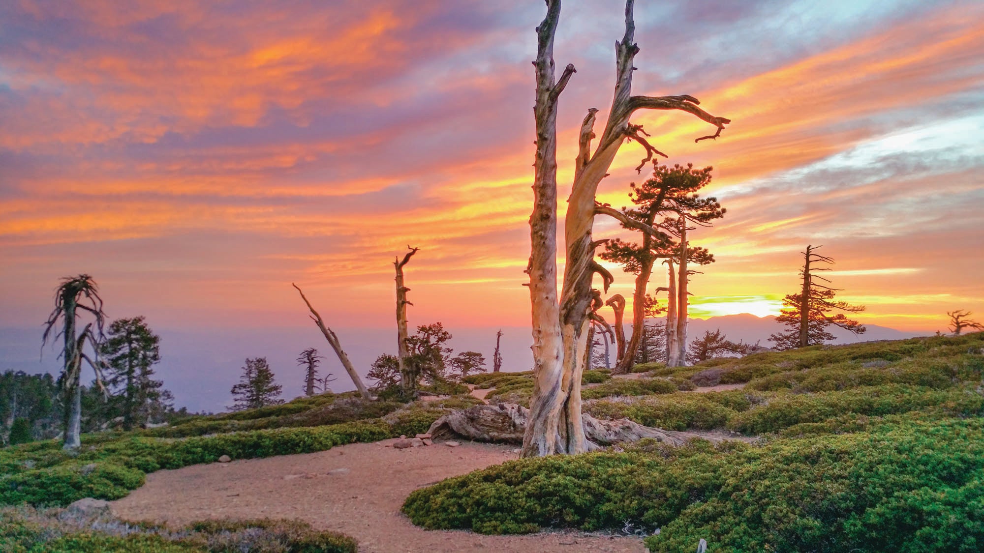
Limber Pine Camp, San Bernadino National Forest, CA
Take in an oceanside sunset with some new friends from a camp 9,000 feet above Los Angeles. A popular backpacking destination and basecamp for cityfolk with summit dreams, this route chops off the top 1,000-plus feet of the climb, which is important for Angelenos coming from sea level. Switchback through an oak and pine forest until it gives way to manzanita, with views north toward Big Bear Lake, and camp after mile 4.5, where you can watch the sunset over the horizon fade into city lights. Next day, climb past treeline passing Washington’s Monument (an 1800s survey marker built by Colonel Henry Washington, which served as the east-west reference point for future surveys of southern California) en route to the rocky summit at mile 7.5. There will be plenty of folks to take your summit pic.
Trailhead San Bernardino Peak (34.1462, -116.9780) Road 2WD Season May to November Permits Required, pick one up at the Mill Creek Visitor Center, or fill out the form online.
ADVERTISEMENT
Also Try: Margy’s Hut, White River National Forest, CO
Trails up Mt. Yeckel, with views of the broad Fryingpan River Valley to the north and Elk Mountains to the south, make 16-person Margy’s Hut a good place to convert some new bunkmates into friends. Follow the Spruce Creek Trail for 7.3 miles.
The Problem: I can’t handle traffic.
You are not alone in your quest for weekend fun. If you’ve got the days, take a half-day Friday and leave early, or take a “weekend” midweek. Otherwise, set two alarms so you can get on the road before dawn. —J.D.
The Problem: All the water sources are dry.
Dry creeks? Dry camp. —M.V.
Haul in water. Plan for one liter of water for every four miles of hiking—more at altitude or in hot, humid weather.
Pack light. All that extra water adds weight—pare down your kit to compensate for it.
Ditch freeze-dried meals. Bring filling, energy-rich grub that isn’t water-dependent, such as wraps, tuna pouches, cheese, energy bars, bagels, and nuts.
Keep drinking water. Don’t let water insecurity drive you to thirst. Sip small amounts of water throughout the day; chugging will overload your system and you’ll pee out the precious moisture before your body has a chance to absorb it.
Plan ahead. Lay off the booze the night before your trip, leave the trailhead hydrated and with full bottles, and stash a cooler full of water in your car for your return. There is nothing more refreshing than a frosty drink of water after a hot and dusty hike.

ADVERTISEMENT
The Problem: The rivers are raging
Snowmelt-swollen rivers can be impassible. Your plan: Follow, rather than ford, them on these trips. —R.W.
East Branch Penobscot, Katahdin Woods and Waters National Monument, ME
When the snow melts in Maine’s North Woods, whipping the East Branch of the Penobscot into a roar, it turns into a secret hotspot for whitewater kayakers and canoers—and a show of waterfalls for backpackers. Stay safely on the western shore by bisecting Katahdin Woods and Waters National Monument on a 32-mile out-and-back from just below Grand Lake Matagamon to where the East Branch meets the Seboeis River. Continue along the International Appalachian Trail—a northward extension of the AT from Katahdin into Canada—past Pond Pitch and Grand Pitch (pictured) waterfalls to the Grand Pitch Lean-To near mile 3.6. The next day, continue south past a few other cascades, periodically swinging from the water’s edge into the maple, oak, birch, and hemlock forests. Reach the Big Seboeis tent-site on the shore of the Penobscot at mile 16 before spending a night and heading back north—all with dry feet.
Trailhead Southern end of Messer Pond Road (46.0800, -68.7952) Road 2WD Season May-October Permits Overnight parking permits required
ADVERTISEMENT
Also Try: Manitou River Trail, George H. Crosby-Manitou State Park, MN
Pass conifers and cascades before sleeping in a secluded camp along the Manitou River on a 9.6-mile overnight. Take the Humpback Trail from Benson Lake to the campsite at mile 5.5 and loop back on the Middle Trail.
Cranberry River Loop, Cranberry Wilderness, WV
This 16.6-mile outing along the North Fork Trail to the Cranberry River passes fishing holes along mossy trails and rocky riverbeds. Connect to WV-76 and the Tumbling Rock Trail.
The Problem: I always think “next weekend will be better.”
Maybe you’re right, maybe not. But either way, you can consider this weekend practice for all the “better” ones to come.