10 of BACKPACKER's All-Time Favorite Hiking Shots

'Martin Radigan Photo'
Catch mountain color—Blue Ridge Mountains, Nevada
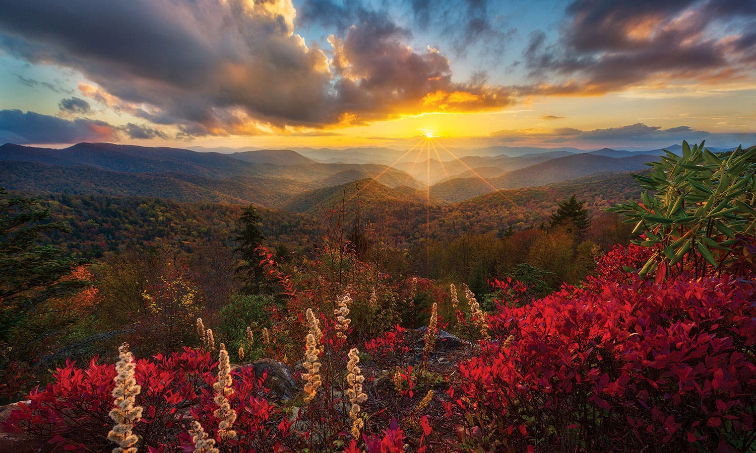
Sorry, summer, the best hiking season is during fall’s prime-time foliage. But don’t sleep through the alarm—the color is fleeting. Here, in the Blue Ridge Mountains, the hardwoods go off between the first and second weeks of October, but the true leaf-peeping connoisseur knows there’s more to it than that. Because you want to go when ground shrubs like sumac turn fiery red (second week of October) and when the sun is setting (6:45 p.m. or so). If you can luck into low-hanging fog (roll of the dice), then it’s just about perfect. The show will be especially good on a thru-hike of the 1,200-mile Mountains-to-Sea Trail, but if you only have a day, try the 4-mile loop that circles Rough Butt Bald. From Bear Pen Gap (milepost 427.6 on the Parkway), near where this photo was snapped, follow a user trail to the MST, which descends into the Blue Ridge’s valleys along fall’s red carpet. That deserves a permanent place on your calendar.
See a different shade of autumn—Valley of Fire State Park, Nevada
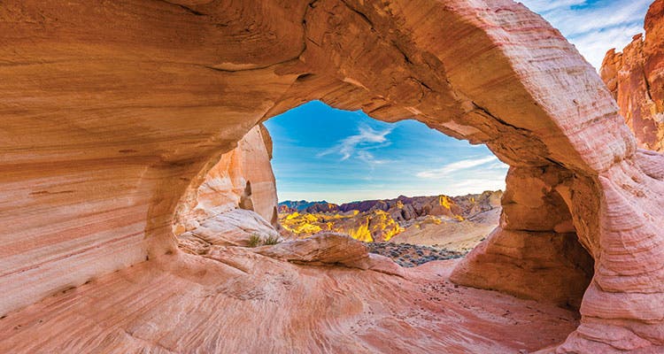
We’re suckers for fall color—in all its forms. Here, in southern Nevada, you can find golden and russet hues that’d compete with the leaves of any hardwood forest. Come October—and then through winter—the sun sits lower on the horizon, illuminating the red rock with brighter colors. Hit the mile-long White Domes Loop in fall-perfect Valley of Fire State Park (October temps in the 70s) to get photographer Dennis Maisel’s vantage through an unnamed, 4-foot-tall arch. But don’t stop there: Continue on the 4.6-mile Prospect Trail, which clambers through red rock to the park’s grove of petrified logs. If color is what you’re after, though, you can always try the Rainbow Vista Trail, 4 miles south off Mouse’s Tank Road.
See in color—San Juan National Forest, CO
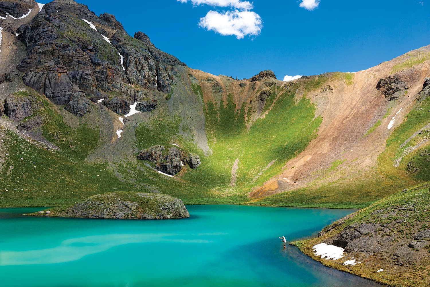
“This spot has the postcard grandeur of the Alps,” says photographer Kennan Harvey. And that’s about where the similarities end, because we guarantee you won’t be shoulder to shoulder with other visitors. Alas, no midday espresso either, unless you pack it in: Island Lake is 4.2 miles from the nearest trailhead.
Check conditions (snowfields may persist through June, though unlikely this year) and head out on the Ice Lakes Trail past its namesake basin, which should be filled with an array of blooms in summer, near mile 2. If you do it as an overnight (recommended), set up camp near Upper Ice Lake in a cirque below five Thirteeners near mile 3.5, then continue .7 mile north to Island Lake (pictured) in the morning. Cast for small cutthroat, see if you can withstand the frigid water long enough to swim 100 yards to the island, or just sit and take it all in. “This is American wilderness. It’s endless,” Harvey says.
Cure summit fever—North Cascades National Park, Washington
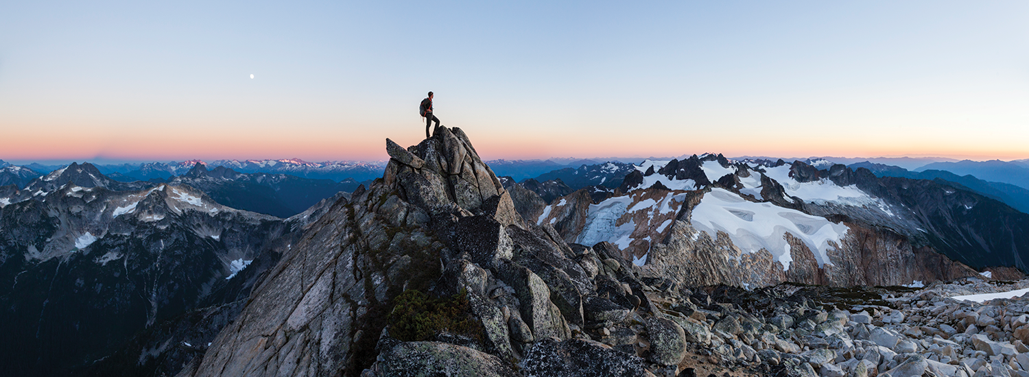
The window is short on the biggest mountains, so take advantage of late summer’s perfect conditions and go now. Ready for its close-up: Mt. Blum in the North Cascades. The 7,685-footer is dotted with tiny, snowmelt-fed hanging tarns and smashed between crinkle-cut ridges, offering a top-of-the-world vantage over the Cascades, including 7,060-foot Hagan Mountain (far right on ridge) and 10,781-foot Mt. Baker (out of the frame, to the right of the photographer). It’s just 4.8 miles to the glacier-encrusted summit, but you must climb more than 7,000 feet in that span. From the Baker River trailhead, follow the silty waterway .5 mile north, then cross over to the east side via a suspension bridge. There, a vague social path follows Blum Creek 2.8 miles to the Blum Lakes, half a dozen pools below their namesake mountain. Find a campsite (first-come, first-serve; permit required), then make the final 1.5-mile push up the peak’s southern flank. (It’s only class 3, but adrenaline junkies can find a more technical ascent on the north face.) If you don’t want to miss the best light, do as photographer Ethan Welty did and bivy near the summit.
Cash in—Pedernales Falls State Park, Texas
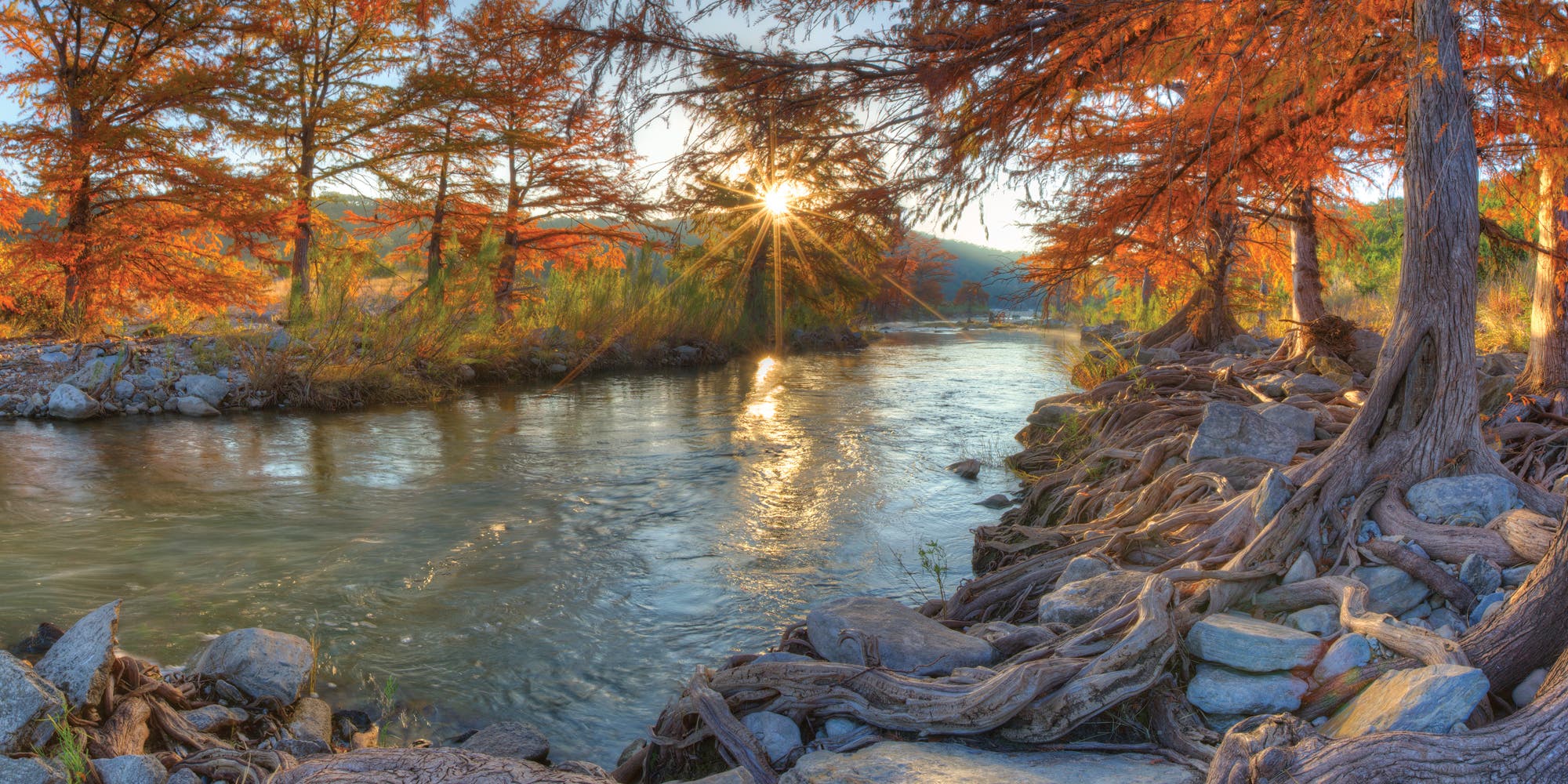
Patience is a virtue in this Austin-area park, where the cypresses don’t typically turn until mid- to late November. But once the mercury starts to drop this far south, the trees look like sunbursts, says photographer Rob Greebon. The best place to see them is clustered along the river, about a mile downstream from the Pedernales Falls trailhead. Follow the easy path to the shore of the small, tiered cascade, then keep going: Alternate between following a social trail and picking your way over limestone embankments and sandy patches to this quiet area where the tangle of cypress roots spiderweb into the river. Turn around for an easy, 2-mile out-and-back, or continue tracing the water as far as you like.
Spring to life—Ozark-St. Francis National Forests, Arkansas

Dust off your boots because, like a juicy red serviceberry, the hike to Sams Throne ripens early. Come April, the Ozarks are made anew by spring’s rain and mild temps, and the dogwoods and redbuds are blossoming. Get an eyeful on the 2-mile out-and-back to 1,888-foot Sams Throne (pictured, middle), where the catwalk-like approach offers near-constant views over the Boston Mountains. From the trailhead off AR 123, head south on the easy-to-follow (though unmarked) user path, tracing the ridge past a collection of exposed, 50- to 75-foot-tall bluff s to Sams Throne. Turn around here and snag a dispersed campsite on top of the sandstone escarpment on the way back (free; first-come, first-serve; BYO water) so you’re sure to be in the best spot for sunrise.
Approach the altar—Bridger Wilderness, Wyoming
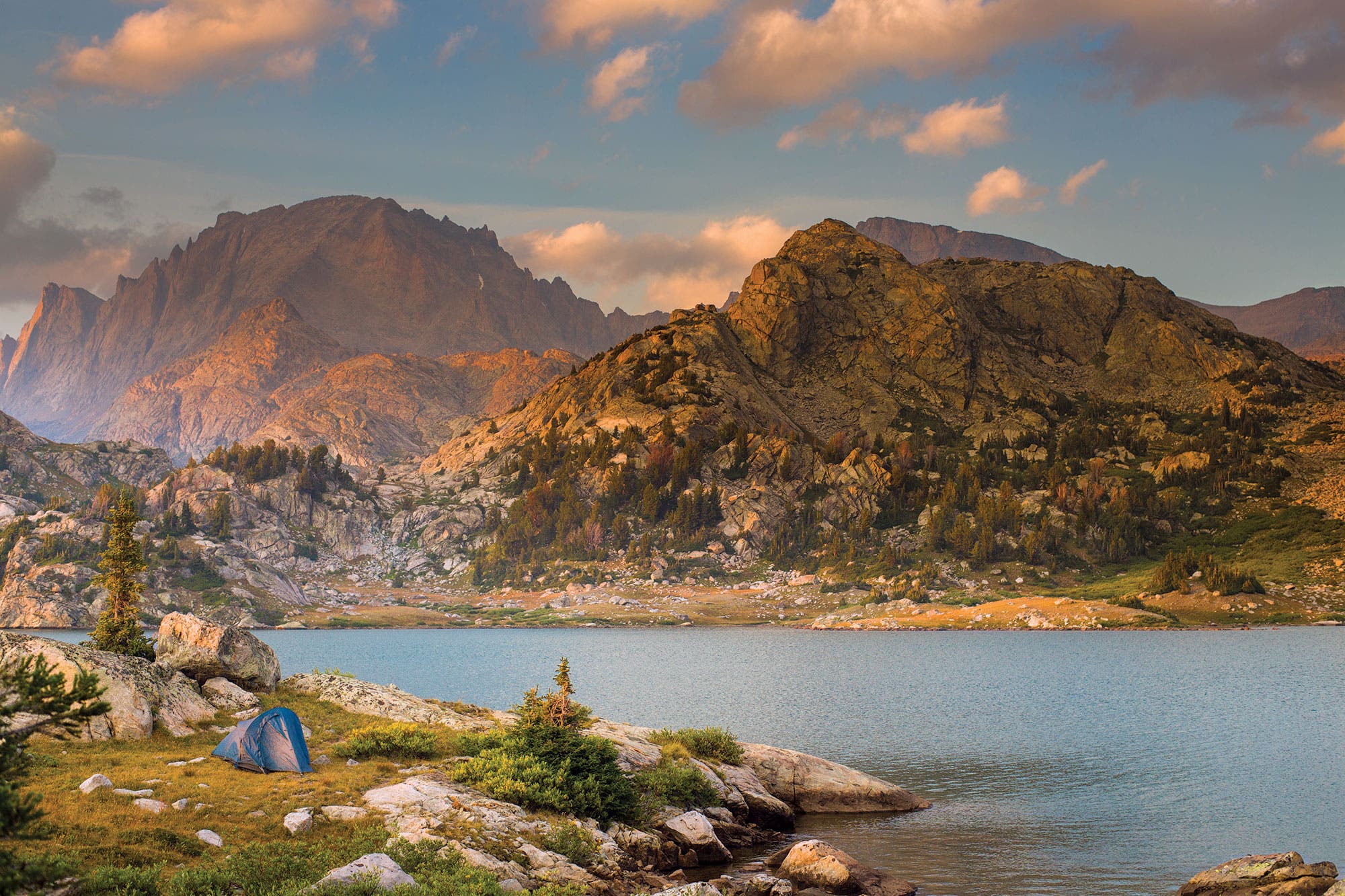
There’s a reason hikers tend to talk about the Wind River Range in hushed tones. Between its pinnacled peaks, high-rise cirques, and turquoise lakes, you just won’t find that many people. That doesn’t mean they don’t know about it, though. Isolation, long approaches, and lack of national park status are the area’s best protectors, keeping it solidly on most backpackers’ life lists—rather than in their photo albums. Change that this September by staging a multiday epic into the granite wonderland when the weather is relatively mild and the wilderness’s notorious ’skeeters have abated. The best way in is via Island Lake (pictured), itself a rough, 12-mile haul from Elkhart Park. From there, you’re right at the fanged mouth of Titcomb Basin, in the heart of the Winds. Link the Pole Creek, Seneca Lake, and Indian Pass Trails to get to the 140-acre tarn, then pitch your tent on an established spot on the southwestern shore of the pool, where tentdoor views frame 13,745-foot Fremont Peak (background) and the crest of the Winds. Next day, you could turn around after a perfectly acceptable introduction to the range, but we recommend exploring the Titcomb Basin Trail, which leads some 4 miles from camp into a glacier-bulldozed cirque of granite massifs that’s sure to leave you speechless.
Take the scenic route—Stephens Gap Callahan Cave Preserve, Alabama
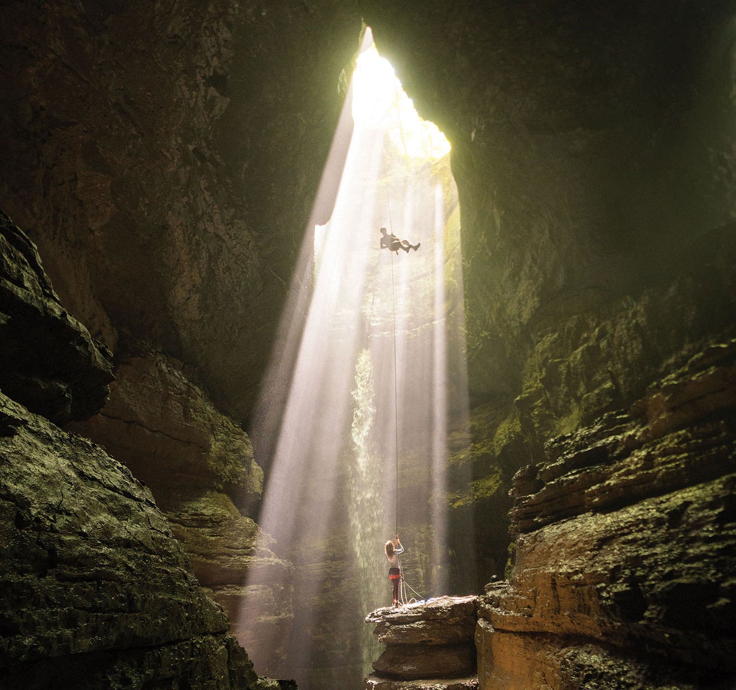
One way to evade late-summer temps in the South? Go underground. It’s not a big hike, but trust us: You won’t mind cooling off in this 143-foot, open-air cave. Better than the natural AC is that Stephens Gap is beginner-friendly and nontechnical. Experienced cavers can, of course, rappel in through the top (pictured), while the rest of us can scramble in near mile .7 of an easy hike from the eponymous trailhead on AL 35. The side entry looks like a vast garage door, and hikers can clamber through it to get to the watery cave floor (wear sturdy shoes; the opening lets in enough natural light that you can forgo a headlamp). PERMIT Required (free)
Take a load off—Little Big Econ State Forest, Florida
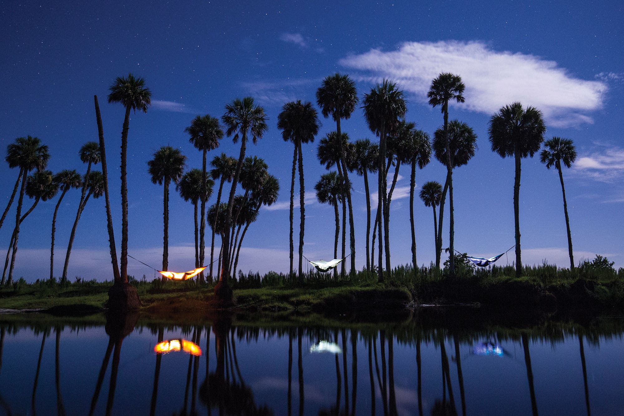
You’ve earned it. With the holidays behind you, get your year o_ffthe ground on the Econlockhatchee River outside of Orlando. There’s no wrong way to stage a trip in this flatwater paradise, but we recommend paddlers put in at the launch on CR 419 and fl oat up to 20 miles east to the St. Johns River. Stop over in the East Camp Area, about 10 to 11 miles from the starting point, to sling a hammock among the waterside oaks and palms or find a patch of dry land for tenting. Not the seafaring sort? That’s OK: Take off on foot from the Barr Street trailhead, following the Florida Trail east along the blackwater river. You’ll pass through the West Camp Area in the first 2 miles—your best bet is to claim a campsite or hammock-friendly pair of trees beside the tannic water, then keep going on the 1.5-mile Kolokee Loop. It follows the Econlockhatchee before doglegging north through pine woods and circling back to the West Camp Area. With January highs in the 70s and few bugs, this is the perfect spot to get your year started on the right foot—or paddle. PERMIT Required for overnighting ($10); call the state forest (407-971-3500) to reserve.
Approach the altar—Acadia National Park, Maine
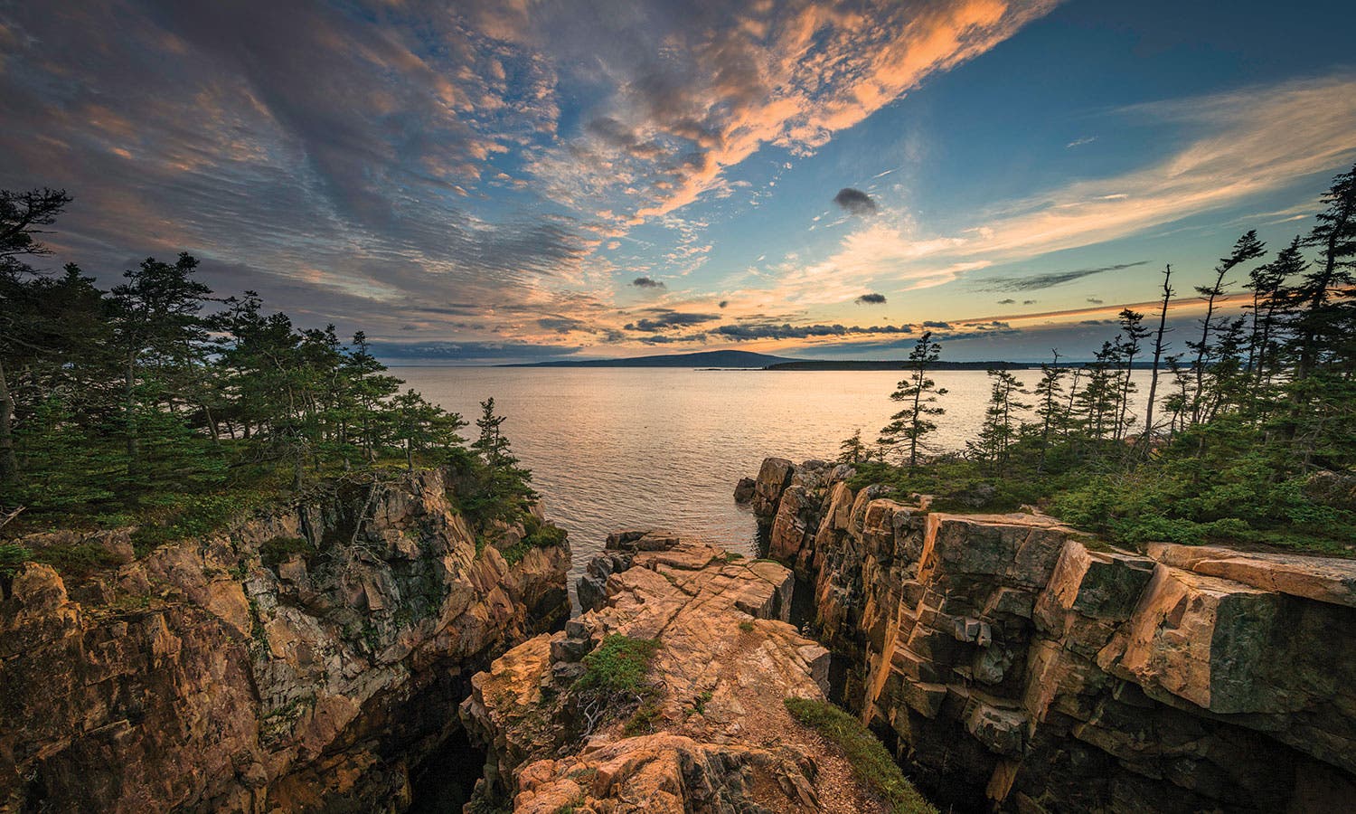
Pilgrims travel far to catch sunrise from 1,529-foot Cadillac Mountain, the highest point along the North Atlantic seaboard. It’s a stunner, but no secret. More than three quarters of a million people visited Acadia last May and June, and most of them came for Mt. Desert Island’s crown. But you can have first light without the crowds if you gun for the Schoodic Peninsula. When Acadia’s boundaries spread eastward to encompass the 1,400-acre promontory in 2015, it opened up a swath of granite shoreline lined with thick forests much like the park’s more popular areas, but far less congested. Visit in June when temperatures hang in the mid-70s and conditions are just about perfect. A handful of short trails spiderweb across the Schoodic Peninsula; link the Alder, Schoodic Head, and Anvil Trails for a 2.1-mile loop. Tack on a .8-mile (round-trip) spur on the East Trail to get up onto the coast. There’s no backpacking in the national park, but the Schoodic Woods Campground has backcountry-feeling, tent-only sites ($22; reservation recommended)—if you want a head start on sunrise. PERMIT None