Updated December 4, 2024 04:44AM
For Thru-Hikers, This Year's Dry Winter Means Water Woes
With snow totals in the western US bleak, seasonal water sources are drying out—and that’s bad news for the backpackers who rely on them.
'Bob Wick/Bureau of Land Management'
Call it the winter that wasn’t: Last season, much of the western United States saw meager snowfall totals that closed ski resorts and left normally blanketed areas all but bare.
Now, as the snows begin to melt, long-distance hikers on the Pacific Crest and Continental Divide Trails are preparing to deal with the consequences. The lingering effects of drought and low snowpack in the Southern Rockies means the seasonal water sources on which hikers rely might be even leaner than usual. Worse yet: models suggest that, in many places, this season may be a preview of the future, as climate change continues to throw weather patterns out of whack. Here’s how that all breaks down on the nation’s three major scenic trails.
Pacific Crest Trail
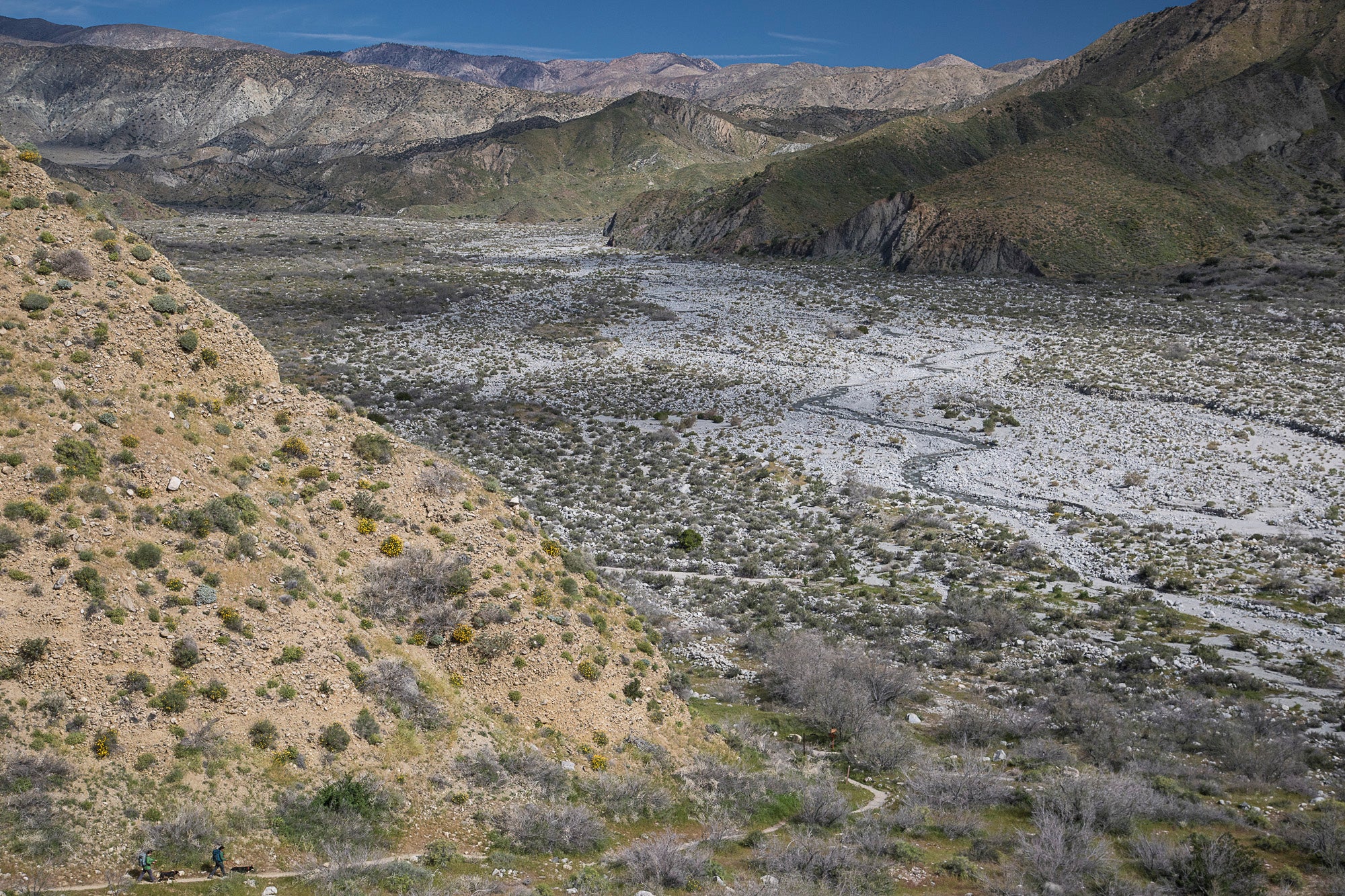
The five-year drought that struck California left the area reeling. “It has been dramatic and worrisome and traumatizing,” says Jack “Found” Haskel, the trail information manager for the Pacific Crest Trail Association. When Haskel hiked the trail in 2006, a wet year, he still ran into 25-mile stretches with no access to water. At the peak of the drought, hikers reported that even some reliable springs had run dry.
And it’s not over yet. This winter, California’s snow totals were meager at best: Even a late-season dump in March wasn’t enough to close the gap. Right now, snowpack is about half of average.
ADVERTISEMENT
Still, Haskel believes that the water shortages shouldn’t be serious enough to stop Pacific Crest Trail hikers. “It’s bad, but it’s not as bad as it could be,” he says. Careful planning is always key, and the association posts updates, but water should be plentiful at least in the early summer months.
The toughest, driest stretches generally concentrate in the southern portion of the trail. What water is available comes through springs. While some went dry at the height of the drought, they seem to have recovered after recent precipitation, though Haskel warns that’s likely to change.
“Later on in the year, when [hikers] get up to northern California, it remains to be seen whether we return to the era of major creeks that usually have water running dry,” he says.
Continental Divide Trail
Hikers on the most rugged path of the Triple Crown have to go out of their way to stay watered—literally. CDT trekkers now regularly shift from the official route through the Gila National Forest to take an alternate that more closely hugs the Gila River and avoids concerns over water in the Black Range. (To be fair, water isn’t the only attraction: ancient dwellings and hot springs abound.)
ADVERTISEMENT
“The Black Range is going to be a little tough for hikers this year, because that’s one area where the water is not super reliable anyway,” says Rachel Brown, trail information and membership services manager for the Continental Divide Trail Coalition, who has hiked the trail through all of Montana, Idaho, Colorado and sections of Wyoming and New Mexico. Volunteers are even discussing the possibility of caching water in the area.
The coalition crowd-sources information on water sources, so hikers can pass word along about what to expect. Early reviews this season are mixed, but forecasts predict continued drought and high temperatures. That could put more of these perennial water sources at risk.
Hot, dry summer months can also exacerbate the risk of forest fires impacting hikers. Last year, Montana took the brunt of it. This year, Brown worries about Colorado, given the low snowpack particularly in the southern portion of the state.
Appalachian Trail
While the East Coast didn’t suffer a dry winter the way the western United States did, hikers could still run into water shortages. Despite the trail’s lush corridors, it’s still prone to seeing seasonal water sources dry up in the summer’s hotter months, in mid-Atlantic states in particular.
ADVERTISEMENT
Blame the warming planet. “If 2018 follows the record-breaking temperatures (and more than occasional droughts) of the past several summers, we anticipate that this will continue to be an issue,” Jordan Bowman, with the Appalachian Trail Conservancy, wrote in an email.
According to the most recent field reports, this year’s water levels and snowpack are about average. But for at least a decade, the Appalachian Trail Conservancy has monitored climate change models for the Georgia-to-Maine route, and the long-term outlook predicts increasing water woes.
Paradoxically, Bowman said that the trail has also seen an increase in late-summer flash rains, which can dump up to an inch a minute on the AT corridor. Rising water levels pose a safety issue for hikers fording streams or rivers: At least one hiker fatality has been attributed to an attempt to ford Maine’s Kennebec River, and these accidents or near misses are likely to increase as extreme weather makes crossings more difficult. Those heavy rain events also erode the trail.