Mount Rainier: Thunder on the Mountain

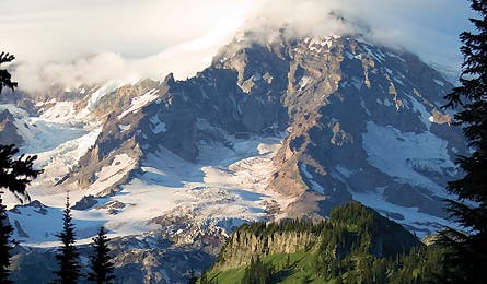
'Lenticular clouds mean high winds on upper Rainier.'
Photos by Gabe Rogel

Lenticular clouds mean high winds on upper Rainier.

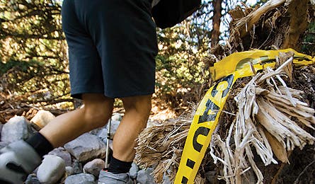
November 2006 storm damage

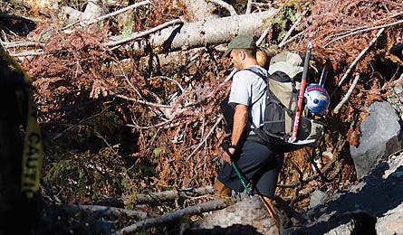
The fallen trees forced the author on many detours.

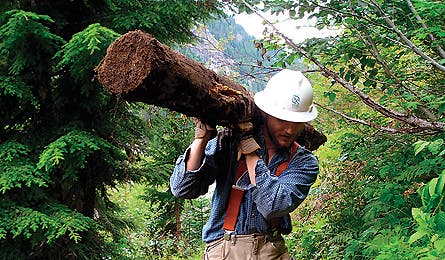
A work crew member cleaning up.
There’s a rock on a mountainside. Maybe it’s smaller than a golf ball, maybe it weighs 20 tons. To gravity, size doesn’t matter. Whether the rock stays put or tumbles downhill will be determined by an eons-old calculus of shape, location, and slope angle. Soil stability makes a difference, of course, as does the amount of vegetation stitching the earth in place. Rainfall can grease the skids, snowmelt too. And retreating glaciers alter the entire equation, introducing multipliers with enormous erosive force. The rocks on Mt. Rainier have behaved fairly consistently since humans first set foot on its sprawling slopes 7,000 years ago. But something has changed in recent decades, scientists say, something that could profoundly alter the experience–and even the safety–of the millions who live and recreate on the Northwest’s most beloved peak. This is the story of The Mountain, as locals affectionately call 14,410-foot Rainier, and the storms that have begun to tear it down.
PROLOGUE
All mountains crumble to the sea, but glaciated stratovolcanoes like the dozen or so in the Cascade Range have been in the accelerated program since their giant ice fields started receding 150 years ago. From Washington’s Mt. Baker to California’s Mt. Shasta, the clatter of rockfall loosed by melting snow is an ever-increasing soundtrack.
Rainier is no exception. It wears the most massive cape of ice in the contiguous United States–26 glaciers spanning 35 square miles. However, like most of the planet’s glaciers, virtually all of Rainier’s are shrinking, a direct and escalating consequence of a warming climate. Seen from Seattle, 40 miles away, the fifth-highest summit in the Lower 48 looks immutable and eternal. In reality, it’s as transitory–in epochal terms–as a sand dune.
Across the Cascades, receding glaciers leave behind steep, barren moraines of loose dirt and friable igneous rock that slide at the slightest disturbance. But Rainier’s massive size and height spawn weather that intensifies the erosion. Storms that brew deep in the Pacific pound the mountain with up to 90 inches of rain each year, and the popular trailhead at Paradise, located at 5,400 feet on the south side of the peak, averages 58 feet of snow annually. All that precipitation transforms Rainier into a 100-square-mile fire hydrant come spring. Seven rivers and hundreds of streams burst from the melt–470 miles of waterways within park boundaries alone.
The rivers carve sediment from the earth as they descend, and carry it downhill. But as on other glaciated volcanoes, Rainier’s water transports so much dirt and rock that its riverbeds rise over time, or aggrade, with the tons of debris that gradually get driven downstream.
This process is normal–a geological cause-and-effect that scientists say happens whenever ice melts. But what’s happened on Rainier in recent years isn’t normal. Rapidly warming temperatures have changed the seasons, creating more rain (vs. snow) and melt (vs. freeze) days at both ends of winter. The result is a higher incidence of destructive floods. It goes like this: Big rainstorms (that should have fallen as snow) abruptly liquefy so-called “wasting” glaciers–essentially perennial snowfields–creating steroidal stream levels. When enough water starts moving, it can scour the aggraded riverbeds, sweeping surplus sediment at frightening speeds. In extreme scenarios, a flood becomes a massive debris flow known as a lahar–a deadly tsunami of mud, boulders, and uprooted trees that can gouge 100-foot-deep gullies, flatten forests, and jump longstanding banks.
If that weren’t enough, lahars also raise riverbed levels farther down the mountain. That may seem innocuous, but it’s a concern in places like Rainier, where the human infrastructure–buildings, trails, and campsites–hasn’t kept pace with the changing terrain. The town of Longmire now sits 29 feet lower than the Nisqually riverbed, protected by a man-made levee, like an alpine New Orleans.
Paul Kennard, Rainier’s geomorphologist, or river specialist, speaks with a scientist’s detached calm about the guillotine suspended over Mt. Rainier National Park. He sees debris flows more frequently now–about four a year for the past five years–and says conditions are ripe for a cataclysmic flood. But his biggest worry isn’t a flood so much as what researchers don’t yet understand: namely, how bad the storms may get, and how soon they’ll arrive.
Many, many rocks sit poised to tumble off Rainier. All that’s needed to unleash them is a really big rainstorm.
NOVEMBER 2006
The first drops fell early in the afternoon on Sunday, November 5. Pacific Northwest winter storms typically blow in on polar jet streams and pass through quickly. But a shift in the jet stream carried this one up from the sub-tropics, possibly from a typhoon in the Sea of Japan. Loaded with moisture, the storm stalled over the Cascades, monsooning 18 inches of rain on Rainier in 36 hours. That’s the equivalent of 15 feet of snow, an amount that easily eclipsed all other weather events in the national park’s 109-year history.
Significantly, the storm also brought unseasonably warm temperatures–Seattle’s TV weathermen call this kind of front a “Pineapple Express.” At a point in the season when the upper mountain rarely sees anything but big white flakes, the storm dumped rain as high as Camp Muir at 10,000 feet, a full 2,000 feet above the existing snowline.
By Monday morning, Longmire was given the order to evacuate. But ranger Lee Taylor missed it, waiting until late afternoon to drive home down Nisqually River Road. She recalls approaching “a big puddle”; only midway through did she realize that Kautz Creek had jumped its banks and reamed out a new channel a quarter-mile east of its former bed. It now rushed over the pavement, a chocolate-colored wave 50 yards across. Water leapt to the tops of her wheel wells. A basketball-size rock bounced across the road. She felt the current pulling her vehicle and hit the gas, barely getting across. “It was sheer luck that I didn’t die,” she says. After the evacuation, five emergency-response park employees remained in Longmire, among them lead climbing ranger Mike “Gator” Gauthier. On Monday evening, at his house a quarter-mile from the Nisqually River, he heard a low rumble, like thunder. He walked to the levee and found the ground quaking from the force of water bowling 20-ton boulders downstream. The musty smell of pumice and ancient volcanic ash hung heavy in the air, mixed with a powerful scent of cedar and pine. And no wonder: The river chewed into its banks, toppling giant old-growth trees and grinding them to wood chips. In his 19 years on Rainier, Gauthier had never seen the Nisqually bigger.
Across the park, every river, creek, and rivulet went mad; an official press release described the scene as a “churning mass of mud, trees, and rocks.” Six debris flows ripped down Rainier’s slopes. Highway 123 washed out in four places, including one gouge as deep as a seven-story building. The Carbon River erased two miles of Carbon River Road. The Nisqually devoured most of Longmire’s levee–coming within inches of some buildings–and demolished five-acre Sunshine Point Campground. Winds reaching 120 mph–the strength of a category three hurricane–strafed Camp Muir and tore the roofs off of two fire towers elsewhere in the park.
The 93-mile Wonderland Trail around Mt. Rainier was battered in more than 30 locations; worst hit were sections in Stevens Canyon (obliterated by a landslide) and along the Carbon River (nearly 2,000 feet of trail washed away). At least two dozen log footbridges disappeared, numerous campsites were destroyed, and the 200-foot-long suspension bridge over Tahoma Creek–which rises 100 feet above the gorge–was rendered unusable.
Never before had a storm damaged every road and trail in the park. Officials tallied $36 million in anticipated repairs and closed the park to private vehicles for a record six months. Two world wars, a mid-1990s government shutdown, and even ash fallout from the 1980 eruption of Mt. St. Helens had failed to close it for more than a few days. Two years later, significant damage remains–and park officials wait for the other shoe to drop.
AUGUST 2007
On a forested canyon wall high above Stevens Creek, the Wonderland Trail disappears abruptly in front of us. Beyond its ragged edge stretches a sun-baked scar where a landslide ripped loose several thousand tons of earth. One hundred-fifty feet wide, it runs for hundreds of feet down to the creek. The steeply pitched minefield of crumbling dirt and rocks doesn’t look stable enough to hold even a squirrel’s weight.
This gap is one of the reasons the Wonderland, for the first time since its completion in 1915, would not be open to thru-hiking for an entire season. (It reopened near the end of summer 2008.) It’s also the reason wilderness rangers strongly discouraged my group from backpacking through here–and why we came, anyway, to view the devastation up close.
Crossing the landslide would be suicide; our only option is bushwhacking uphill around it. Willie Ehrenclou, a 27-year-old field coordinator for the massive recovery project launched by the Student Conservation Association, grabs branches and scrabbles up the steep slope, plunging into the thicket above. I follow with BACKPACKER associate editor Shannon Davis and my friend Bill Mistretta from Colorado.
Virtually every step is an effort somewhere between wrestling and rock climbing. We haul ourselves through vine maple, slide alder, and devil’s club, branches whipping our legs and snagging our packs. Within minutes, I’m panting and sweat drips into my eyes. I can hear Willie just ahead of me, but I can’t see him through the brush. At a gully, we nervously downclimb an eight-foot wall of dried mud; protruding rocks and sheared-off roots provide tenuous holds.
Twenty strenuous minutes later, we stand at the opposite end of the landslide, having covered a distance that would have taken a casual 30 seconds on trail. While it’s the biggest washout we’ll see on this three-day hike, it’s already the fourth we’ve encountered in our first hour this morning.
As our hearts return to a resting cadence, I think of something longtime trail foreman Carl Fabiani told me. “We’ve gone through so many 100-year floods in the last 20 years,” he said, “that people are starting to rethink that rating system.” Indeed, November 2006–a 400-year flood–was the third 100-plus-year event to hit the region in 11 years, following similar storms in 1995 and 2003. The Union of Concerned Scientists and other researchers now believe these floods will become a more common occurrence. Reaching the former site of Pyramid Creek Camp brings home–very starkly–the risk for backcountry hikers. On our second afternoon, we find its ruins 25 feet down a partly obliterated spur from the main trail. A short metal post and downed sign are the only evidence that backpackers once pitched tents here. The rest of the camp is buried beneath a rippled crust as hard as asphalt and a spaghetti heap of mud-caked trees, some two feet in diameter, their bark stripped off and roots jutting out like live wires from a severed power line. An ugly, dry furrow four feet deep and 10 feet wide marks where Pyramid Creek, after derailing from its channel a minute’s walk west of here, bulldozed through the camp.
I scramble onto a wobbly stack of lumber as tall as I am, and imagine lying in a tent as the wave of boulders and trees issued its roaring alarm seconds before obliterating the camp. No one was here when debris flows ripped through in 2005 and 2006. But judging by the destruction, no one would have survived.
NOVEMBER 2008
Few would criticize the raining of public attention and funds on national parks like Rainier and Olympic, where key roads were also closed for months after the November 2006 storm. But the region’s national forests sustained similar damage and suffer from crippling maintenance backlogs that will severely limit access for years. Since the 2003 floods, hikers haven’t been able to reach many trails on the west and north sides of the nearby Glacier Peak Wilderness, and two key roads there remain closed. Mudslides caused by the 2003 storm also obliterated seven footbridges and many miles on the Pacific Crest Trail; backpackers are still following a 50-mile detour.
And these examples represent just a small fraction of the outstanding storm damage. According to the Washington Trails Association, the 2006 tempest affected 150 paths around the Northwest. The tab for fixing roads and trails might reach $70 million. Five debris flows took big bites out of the 41-mile Timberline Trail looping Mt. Hood; the segment between Cloud Cap and Elk Cove isn’t expected to reopen before this summer. Damage in Washington’s Mt. Baker-Snoqualmie National Forest alone totals $11 million, and crews there haven’t even finished cleaning up from 2003.
While the wreckage has been leavened by a massive outpouring of volunteer labor, the future of trail rebuilding in the Northwest looks bleak. Despite the destruction, Mt. Baker-Snoqualmie’s 2007 budget for repairs was a paltry $15,000. And experts say that even well-funded parks will struggle to keep pace with more frequent monster floods.
The Union of Concerned Scientists says it expects warmer temperatures to crank up the hydrological cycle, pumping more moisture into the atmosphere and spawning more huge storms. Various studies support that prediction. A 2005 analysis forecast a 140 percent leap in “extreme precipitation events” in the Pacific Northwest–primarily between November and January. And in a 2006 study, Oregon State University climatologist Anne Nolin predicted that, by mid-century, 22 percent of Oregon’s Cascades and 60 percent of the Olympic Mountains–an area exceeding 3,500 square miles–could see rain falling in winter at elevations that now get snow. Even where the white stuff holds out, it will fall in temps closer to freezing, making it more susceptible to rapid melting. As for the so-called Pineapple Expresses, Portland State University’s Andrew Fountain simply told me, “You’re going to see more of that.” Even if the scientists are wrong and climate change doesn’t trigger more-frequent superstorms, the drain plug has already been pulled on the Cascade volcanoes. Glacial recession, aggradation, debris flows–they’ve all accelerated to a point where reversal (and maybe even stasis) is at least a century away, and only if we cap CO2 emissions now. Of course, moraines left behind by retreating glaciers will eventually stabilize, cover with vegetation, and spawn fewer debris flows. But with glaciers marching uphill for decades to come–exposing more moraine, incubating more lahars–terrain stability seems a very distant resolution. It seems clear that hikers and park officials will have to adapt to more road and trail closures, to floods that come closer to houses and other facilities, and to a landscape that looks and behaves unlike anything we’ve known. In the meantime, another 100-year storm could strike.
And it did. On December 3, 2007, a titanic storm slammed the Northwest. Rainier saw six inches of rain, and the Olympic Peninsula was pounded by 14 in 48 hours. Mudslides tore up roads and campgrounds in the Olympics and flattened thousands of trees; several rivers breached 500-year flood levels. The combined repair tab for the peninsula’s national park and forest: $19 million.
Epilogue
Gazing at Rainier’s tattered cape of glaciers, too immense for the eye to measure, it seems at once impossible, amazing, and frightening that we are capable of affecting the climate in a way that could alter the topography of this mountain. But our complicity in the crisis feels almost irrelevant when you visit Rainier and stand beside an enormous toothpick pile of giant trees laid flat in a single instant of muddy devastation.
Clearly, we’ll have to adapt our vision of wilderness to a new reality. The usual global warming stories about rising sea levels and endangered polar bears require a certain intellectual patience, a faith in science. Those changes happen slowly, distantly, somehow out there. Rainier’s debris flows illustrate the vicious messiness and proximity of climate change.
There’s a rock on a mountainside. It is very, very old. But in many respects, its story has only just begun.
Northwest editor Michael Lanza lives in sunny and lahar-free Boise, Idaho.
CLEANING UP THE MESS
A look inside the work done by crews to repair Rainier’s trails after the November 2006 storm.
As the flood’s damage became better known, park officials received thousands of calls and emails offering help. Nonprofit groups pitched in, too. The Student Conservation Association set up an office at Longmire and led a volunteer effort that pulled in crews and funding from the Washington Trails Association, The Mountaineers, and the National Parks Conservation Association. The free labor nearly offset the storm’s destruction: In 2007, 1,724 volunteers contributed more than 84,000 hours of trail work, worth $1.5 million and roughly twice the park’s volunteer output in a typical year. At press time, officials expected 2008 volunteer hours to reach 60,000.
Once completed, the Rainier project will rival the Yellowstone recovery effort after the fires of 1988. Jay Satz, SCA’s chief organizer on Rainier, also led SCA’s push in Wyoming. While the breadth of damage in Yellowstone was greater, he says, more people have already served at Rainier. “In 2007 alone,” he recounts, “SCA volunteers cleared 335 campsites, 222 road culverts, and 90,000 feet of trail–and built 3,600 feet of new trail.” (The work continues. For information or to volunteer, go to thesca.org/mt_rainier_recovery.)
Damage Assessment
How big a hit did Rainier take in the November 2006 tempest? How will it fare in the future? From top to bottom, here’s a complete report card.
The Climbs
Rainier’s higher elevations escaped the storm’s fury and won’t see much change in the foreseeable future. But mountaineers are already coping with climate-induced changes lower on The Mountain. In 2007, collapsing snow bridges, gaping crevasses, and increased rockfall chased climbers off the popular Disappointment Cleaver route and onto an Emmons Glacier detour by midsummer. Climbing ranger Mike Gauthier says that’s the earliest he can remember in 19 years on the peak. Other Rainier vets agree there’s less snow, and the Inter Glacier , the main avenue to Camp Schurman, is a half-mile shorter than 50 years ago.
The Glaciers
The University of Washington’s Climate Impacts Group forecasts a 1°F increase in regional temperatures in the next 20 years, equal to the entire gain of the past century. This means the Northwest’s glaciers will continue to shrink. Satellite photos show Rainier’s Nisqually , Winthrop, Tahoma, South Tahoma, and Carbon Glaciers at or approaching their historic minimum size; the Nisqually alone has retreated more than a half-mile since 1936. A sliver of good news: The tipping point may be far away. Scientists think Rainier’s elevation will preserve glaciers on its upper flanks for the foreseeable future, and some believe a climate change-induced increase in precipitation could help some glaciers grow.
The Forests
Mt. Rainier and Olympic National Parks contain the last temperate old-growth forests in the Lower 48, with trees up to 1,000 years old and more than 200 feet tall. But rising riverbeds threaten these forests. The White River’s bed has risen enough to begin suffocating acres of ancient Douglas fir, cedar, and hemlock. The Ohanapecosh River flooded during the 2006 storm, depositing three to four feet of silt in the Grove of the Patriarchs.
The Guides
Business for climbing guides on Rainier has been good in part because the Nisqually River Road has been a dependable artery to Paradise , the gateway for the mountain’s most popular routes. So it was with some concern that Peter Whittaker, co-owner of Rainier Mountaineering, Inc., watched trucks rumble past his Ashford office carrying car-size boulders to rebuild the road. The Nisqually’s bed sits higher than the pavement in places, and park officials expect challenges keeping the road open. Says Whittaker, who has summited Rainier more than 200 times, “We hope we can maintain that road, [but] we may be fighting a losing battle.”
The Meadows
Covering nearly a quarter of the park, Rainier’s subalpine meadows are a major draw. But trees are now growing in areas at Paradise that have been open for more than a century. And a 1996 study concluded that warmer summers will encourage additional growth in west-side meadows like Spray Park, where snow cover is deep and melts off more slowly because of the cooler, northerly exposure.
The Campsites
Before 2005, there hadn’t been a lahar on Pyramid Creek in the park’s recorded history. But on September 30, five inches of rain fell, and a debris flow–one of four on Rainier that day–wiped out two tent sites at Pyramid Creek Camp , located along the Wonderland Trail in the southern tier of the park. A November 2006 lahar finished off the camp. No other backcountry camps have seen such catastrophic damage–yet. But rangers now warn backpackers to run like hell uphill if they hear the sound of a train approaching near any creek or river: It could be a lahar.
The Wonderland Trail
For almost two years, backpackers could not thru-hike this classic circumambulation because of washouts in Stevens Canyon (150 feet of trail gone) and along the Carbon River (1,500 to 2,000 feet of trail). The Stevens Canyon section reopened in August 2008, but hikers are still using a reroute around the Carbon. Of course, the storm didn’t just hit the Wonderland: Wilderness permits dropped to 2,195 in 2007 due to limited access, down about 1,200 from an average year. Thanks to park and volunteer trail crews, 2008’s numbers rebounded to 4,135 permits.