Master Class: Read the Wilderness

'Look for clues in the landscape. (B. Pilgrim)'

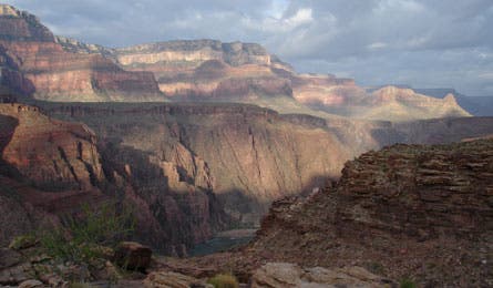
Look for clues in the landscape. (B. Pilgrim)

Use the sun’s position to estimate remaining daylight. (James Senter)

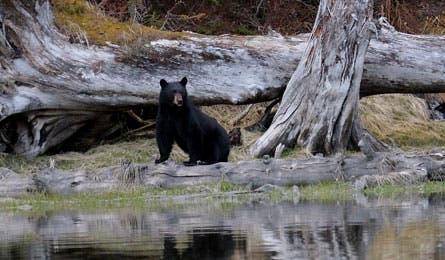
Predators, like bears, leave signs of their presence. (John Jaques)

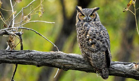
Watch birds for signs of changing conditions. (Greg McCrimmon)
Tune in to Nature
The key to using natural signs? Combining subtleties into a big-picture appreciation of your surroundings. The benefit? Smarter and safer wilderness routefinding. If possible, get a high vantage, which will provide a better angle for spotting terrain and environmental clues like: approaching storms, distinct landmarks, potential escape routes (like roads), dense areas of vegetation (often south-facing), easy bushwhacking, and likely water sources.
Use Your Senses to Guide You
Get your bearings by seeing, hearing, and feeling signs of terrain changes and shifting weather conditions.
Train your eyes. Look up, down, side-to-side, and turn around for a peek behind you. Changing your field of view and depth of vision frequently will help you see important clues both big and small. That could mean the first hint of a storm brewing in the distance or faint game trails in dense brush.
Listen for leads. Echoes can help you determine distances: For each 500 feet, an echo will take one second to bounce back to you. Pay attention to a shift in volume: Cold and humid air, which often precedes a front, carries sound better than warm dry air, so noises travel farther and seem louder pre-storm.
Feel subtle clues. Use touch to orient yourself and anticipate weather. The south side of boulders and trees will feel warmer than the north, and wind speed increases may indicate shifting weather. Note changes underfoot: Windward ridges have more gravely soil, and wet canyons can hint at flood potential.
TIP: Estimate Daylight
Hold your flattened palm (fingers together) at arm’s length and align your top finger with the bottom of the sun. For each finger width between the sun and the horizon, you have roughly 15 minutes of remaining light.
TIP: Learn Prevailing Winds
They shape terrain and vegetation over time, so even in shifting wind, clues from prevailing conditions may help you orient.
Find North at Night
Work out the cardinal directions with this no-compass-needed technique.
Look for the Big Dipper, a distinct saucepan shaped by seven stars. Identify the two stars farthest from the constellation’s “handle” and take note of the distance between them. Extend an imaginary line from the two stars skyward, about five times that distance. The line points to Polaris, aka the North Star. To find north, draw another line connecting Polaris to the Earth’s horizon. Where it hits will be within one degree of true north. Learn other direction-finding techniques at backpacker.com/findnorth.
Learn from Trees
Use a weather-worn tree to orient yourself and find a protected site.
Choose a telling specimen. The elements’ effects are clearest on old, isolated, deciduous trees. In a crowded or evergreen forest, study the largest-diameter tree. Circle it several times to get a good view from all sides.
Use your observations to:
- Find north. Determine which side has the most branches and leaves. In the northern hemisphere, usually the south side is fullest and south-facing branches often grow straight out, away from the trunk. Northfacing ones are thinner and grow upward.
- Pick a campsite. Bent or combed-over branch tips can signal prevailing wind direction. For the best windblocking effect, set up camp between 1.5 and five tree-lengths from a stand of trees. Broken branches on a tree’s uphill side may indicate that it’s in an avalanche zone; move away from the slope to camp.
Identify Hidden Paths
Look for signs of animal traffic: beaten ground, marked trees, tracks, scat, broken grass, torn leaves, etc. Drop to one knee or climb a hill; a new vantage can reveal a hidden trail.
Heed Danger Signs
Translate observations into safe routefinding strategies.
What you observe: A half-eaten animal carcass covered with loosely piled soil, leaves, or snow
What it means: Predators like cougars, foxes, and weasels cache half-eaten kills, but often remain near the food source—and defend it aggressively.
How to Travel: Back away from the carcass quickly and without disturbing it, but don’t run, which could trigger a predatory response if the hunter’s nearby. Give the cache a berth of at least 100 yards as you go around it (on the upwind side).
What you observe: Roaring noise and limited visibility as you approach a mellow stream crossing
What it means: Water’s noise increases in steeps and near confluences and rapids. If river bends or vegetation block your up- and downstream views, the sound could signal an unseen danger.
How to Travel: Walk downstream to check for rapids, waterfalls, or major strainers before committing. Cross below (never above) rapids, and look for wide shallows to traverse, not fast-moving bends. Unclip your pack and keep your shoes on for the crossing.
What you observe: Increasingly humid air and decreasing visibility of far-off landforms
What it means: Rising moisture in the air reduces visibility and is an early sign of an approaching thunderstorm. Other early signals include gusty winds, temperature swings, and building clouds.
How to Travel: Especially if you’re above treeline or on a ridge, be alert to other signs of approaching storms and scout routes toward uniform forests and lower terrain. Descend preemptively: Don’t wait until you see or hear flashes to find safe terrain.
What you observe: Foot-long scratches in a tree trunk (at a height of about six feet) and large overturned rocks nearby
What it means: Dominant male black bears mark their scratching posts (often smooth-barked trees like aspen and poplar). They also dig for grubs under rocks and logs.
How to Travel: Stick together as a group and sing or shout; be especially noisy if you’re headed into the wind. Set up your cooking area first (100 yards downwind of where you want to camp) so you don’t track odors near your tent.
TIP: Wind Vane Webs
Spiders often build on the leeward side of trees and rocks, thus indicating protected areas and providing clues to prevailing wind direction.
TIP: Forage
Hunt for berries on south-facing slopes where plants grow more (and sweeter) fruit. Almost all aggregate berries (like raspberries) are safe to eat.
Watch for Extremes
Use landscape-specific details to pick the right path in snow and sand.
Snow
- Listen for water running under the surface; falling through a snowbridge may trap you in a flooded tunnel or soak your feet, putting you at risk for frostbite. Jam your pole into the snow to test firmness underfoot before walking on snow over waterways.
- Hard snow chunks, large surface cracks, or visible rock deposits atop a snowy surface may all indicate avalanche activity. When snow is unstable or you see signs of slides, move off of and away from steeps and travel in dense trees, on ridges, or in wide valleys.
- Blowing snow is not a good indicator of wind direction. When building a wind block, look for evidence that has built up over hours or days: The narrow tips of elongated erosional ridges (called sastrugi) point into the wind. Scour holes form on the windward side of rocks and trees; drifts form in their lee.
Deserts
- Prevailing winds shape dunes into crescents or ridges. Walk on the windward side where slopes are mellower and sand is packed.
- As you hike, regularly take note of your shadow’s profile while you’re on course. Though the shadow’s shape and length will change throughout the day, if you get turned around you can use a recent memory of it to help reorient.
TIP: Look Up
Cloud movement overhead can signal wind direction even if dense trees block you from feeling it.
Know Your Birds
Watch local and migratory species for clues to weather and terrain. Warblers stay within a mile of water, snow geese fly north in spring and south in winter, insect-eaters like swallows change flight patterns pre-storm (flying low when bad weather is coming), gray jays nest in subalpine areas (so you’re approaching open alpine terrain), and ptarmigans live almost exclusively above treeline. Note: Watch flock (not individual) behavior.