Google Releases Street View of Mount Kinabalu

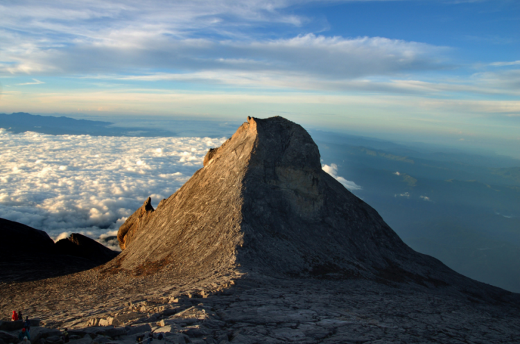
'Now you, too, can score this view on top of Mount Kinabalu via Google Street View. (Photo by amrufm/Flickr)'
You can now summit Malaysia’s Mount Kinabalu via your smartphone or computer—thanks to the latest addition to Google Street View.
There have been a great deal of recent additions to Street View, including many Malaysian tourist sites, but Nhazlisham Hamdan, Google’s Street View Operations Lead for Malaysia, Indonesia & Thailand, said the highlight is without a doubt Kinabalu, the country’s tallest mountain, located in the eastern state of Sabah.
“From today you too can catch your breath, in awe, at the beauty of Sabah with the launch of new Street View imagery from 23 islands and nature reserves from the area,” Hamdan wrote in a blog post.
The panoramic images were captured by the Google Street View Trekker—a backpack-mounted camera that was carried up the trail. Street View now covers 80 percent of east Malaysia.
Datuk Seri Masidi Manjun, the State Tourism, Culture and Environment minister, said he hopes “this virtual exploration of Sabah’s natural environment will translate into visits here.”
Google Street View will update its views of Mount Kinabalu once it is reopened Dec. 1, following an earthquake that damaged the trail over the summer.