Published March 20, 2008 05:08PM
Find Your Watershed
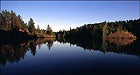
With threats as varied as global warming, pollution, and invasive species plaguing our rivers, it’d be nice to know exactly where our water comes from and what’s happening with it. For lucky folks who live in Idaho, Oregon, Washington, and California, the environmental group Ecotrust just released a nifty web tool called Find Your Watershed. The slickly automated maps and stats show data as varied and detailed as how many miles of streams host migrating salmon, number of dams, minimum and maximum elevation, LEED-certified buildings, recognized forests, and connections to other watersheds.
In the near future, Ecotrust hopes to provide links for each watershed to environmental and community groups that can advocate on behalf of each region’s natural water supply. Though Ecotrust seems heavily invested in West-Coast watershed and salmon preservation, we can hope they’ll move on to include the rest of the U.S. After all, there’s a lot of fish that need savin’ everywhere else, too.
In the meantime, non-Pacific Timers can check out the EPA’s Surf Your Watershed tool. It’s not as sexy as Ecotrust’s site, but it still provides tons of intricate environmental data about your watershed.
Next time, you can check on the health of your local streams before you go jump in a lake. — Ted Alvarez
Find Your Watershed
Surf Your Watershed
(photo credit: Explore Minnesota Tourism)
Via High Country News’ GOAT