Published February 16, 2021 03:34PM
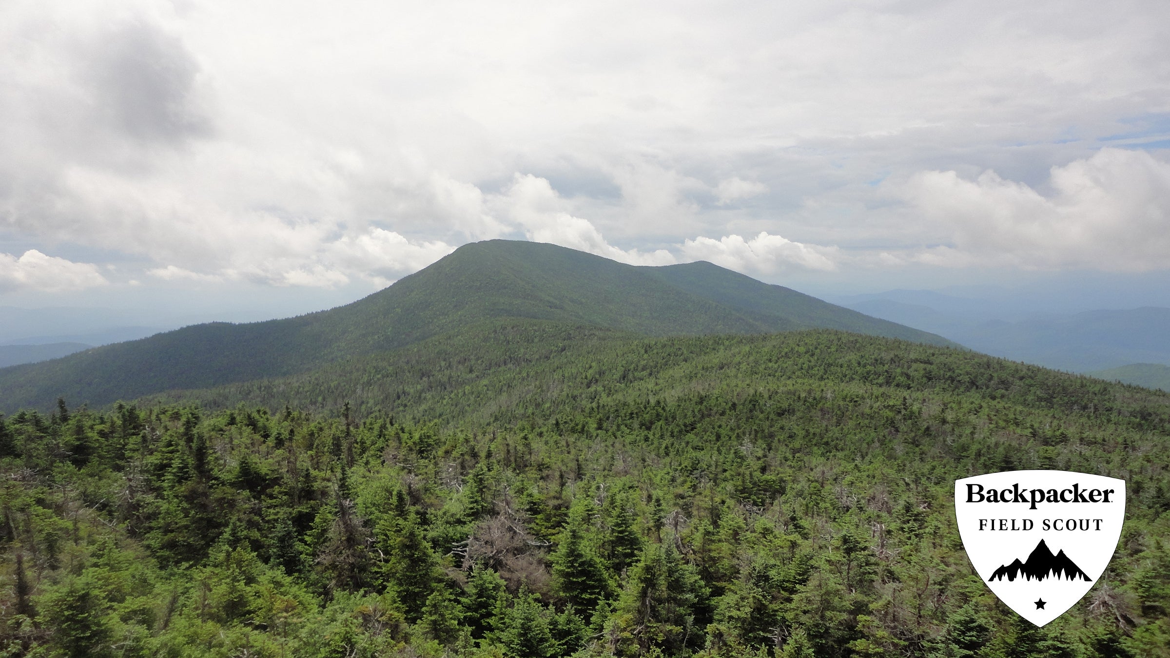
Santanoni Range, Adirondacks, NY
Explore a New York's little-known Santanoni Ridge while bagging three Adirondack 46ers on this challenging overnight.
(Photo: Ryan Wichelns)
The Santanoni Range might have more bushwhacks than views, but that just keeps the crowds away—and nets my hiking partners and me a weekend of solitude. After following the Bradley Pond Trail in to its namesake, we set up at the lean-to and enjoyed a rare, legal ADKs fire. That was it for official trails for the rest of the weekend. Coming our way was routefinding over dense ridges, pine trees to scrape at our arms and pull at our clothes, and summits without much more than a wooden sign to mark the top.
When we finally emerge back at the trailhead, we are tired, dirty, and pretty scratched up. I think back to hearing a beaver splash around in the darkened pond beyond our camp at Bradley Pond. It was the loudest noise both that night and the day of solitary routefinding that followed. But even with all the bushwhacking and the bugs, I have no doubts: It was worth it.
| Trip Stats | |||
| Distance: 16.6 miles | Difficulty: 4/5 | Rating: 3.5/5 | Duration: 2 days |
Turn-By-Turn
- From a gated trailhead off Tahawus Road, follow the two-lane path west looking for a trail on the right at 1.8 miles. Turn right (north) off the road onto Bradley Pond Trail.
- Follow the trail along Santanoni Brook, climbing toward Bradley Pond. Just past the pond, snag a lean-to on the right at mile 4.7. (Full? There’s also a designated tentsite nearby.)
- The following morning, backtrack .25 mile south and look for a user path leaving the trail heading right (west) around the north side of Bradley Pond. The trail meets Santanoni Brook and climbs the drainage to a point just south of Panther Peak at mile 6.5—This four corners point is known as “Times Square.”
- The hike from here up 4,442-foot Panther Peak is a quick .5 mile. Tag the summit and return to Times Square.
- Next up: 3,820-foot Couchsachraga Peak. Head west from Times Square, following the ridgeline down to a saddle, then climb back up to the summit at mile 8.8. Retrace your steps to Times Square.
- Finally, head south from the intersection along another ridgeline toward 4,606 Santanoni Peak. Summit at mile 11.5.
- Retrace your steps towards Times Square for .1 mile, until you see a user path on the right (east). Follow it onto Santanoni’s northeast ridge, then down into a drainage just south of Santanoni Brook. Pop back out on the main Bradley Pond Trail at mile 13, about a mile south of the lean-to. Head south on the Bradley Pond Trail then the road to your car at mile 16.6.
Trip Planner
Permit none Contact Visit Adirondacks GPX Download