Published February 23, 2021 07:05AM
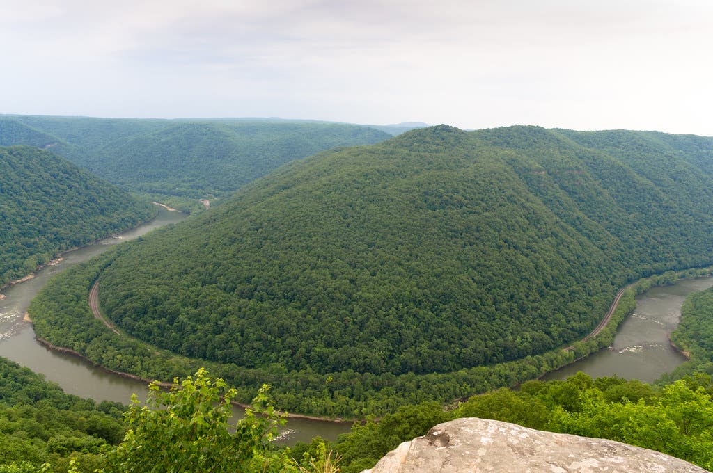
Explore New River Gorge, America’s Newest National Park
With more than 100 miles of hiking trails, there’s no shortage of exploring to be done in this West Virginia getaway, which became America’s 63rd national park in December 2020. A local shows you how it’s done.
(Photo: JPMueller99 (CC-BY 2.0))
The Insider
Eve West has been in the park service for almost 30 years. She first came to New River Gorge National Park and Preserve back in the fall of 2010 as a volunteer, fell in love with the region, and decided to stay; since then, she’s held several roles within the park and last year was named Chief of Interpretation and Cultural Resources.
Views from Above
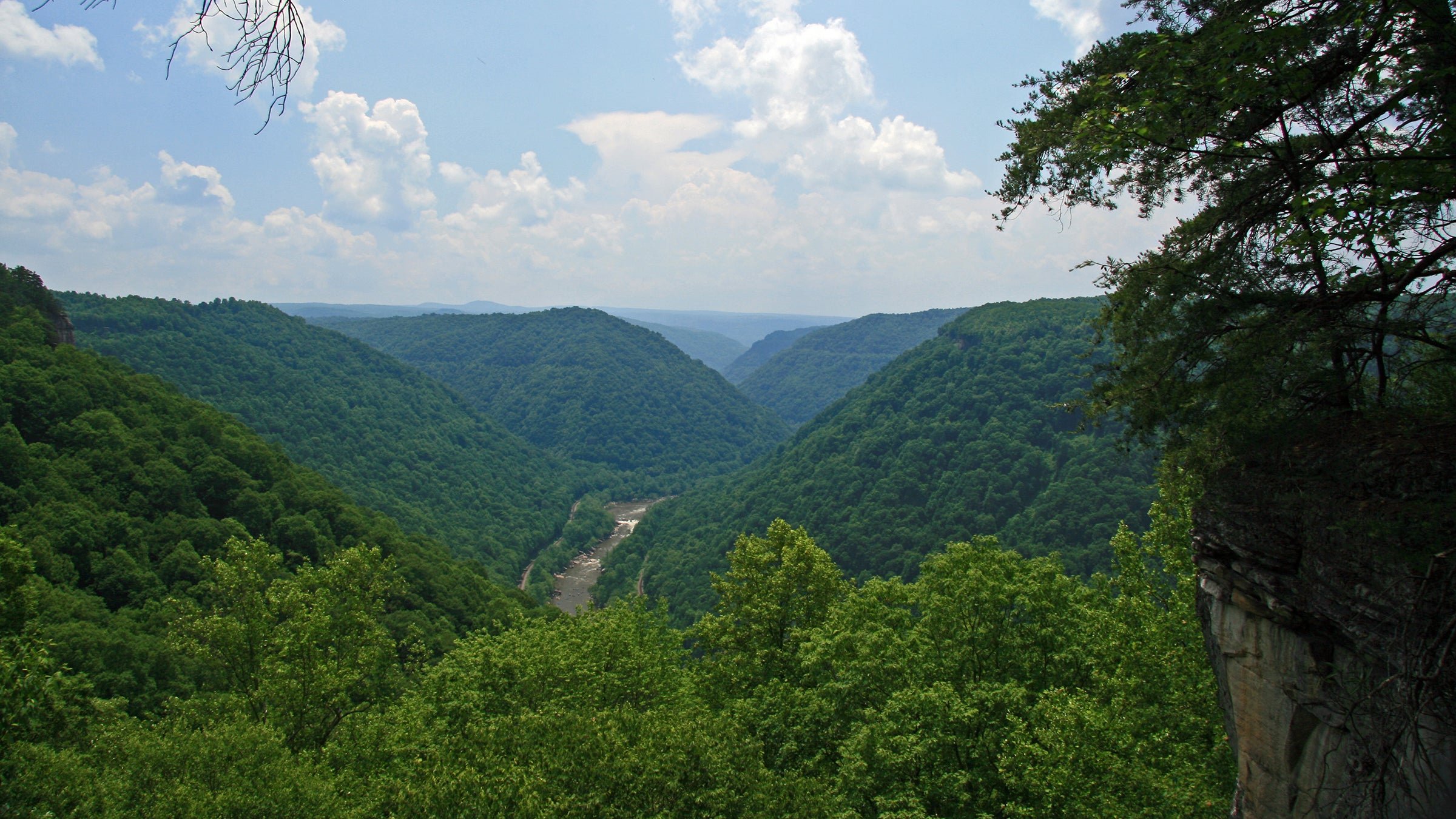
Grandview, one of four sections in the national park, is perched high above the rest of New River Gorge. “It’s a beautiful area,” says West, “with great views looking down to the New River.”
Her favorite place to catch those views is Canyon Rim Trail. The 3.2-mile out-and-back starts at Grandview’s Main Overlook. At 1,400 feet above the riverbed, this is the highest point from “rim to river in the park,” according to West. There’s more to see than just distant views, though; the Rim Trail also passes through rhododendron forest and groves of hemlocks, where keen-eyed hikers can spot native bird species like the wood warbler. “We have incredible biodiversity here,” says West. “We’re actually considered the most botanically diverse river system in the central and southern Appalachian Mountains.” Forty-one different forest communities coexist in the park as part of the largest remaining midatlantic forest on the globe, while also providing critical habitat for neotropical songbirds and climate-displaced species from less-resilient ecosystems nearby.
ADVERTISEMENT
A Walk in the Woods
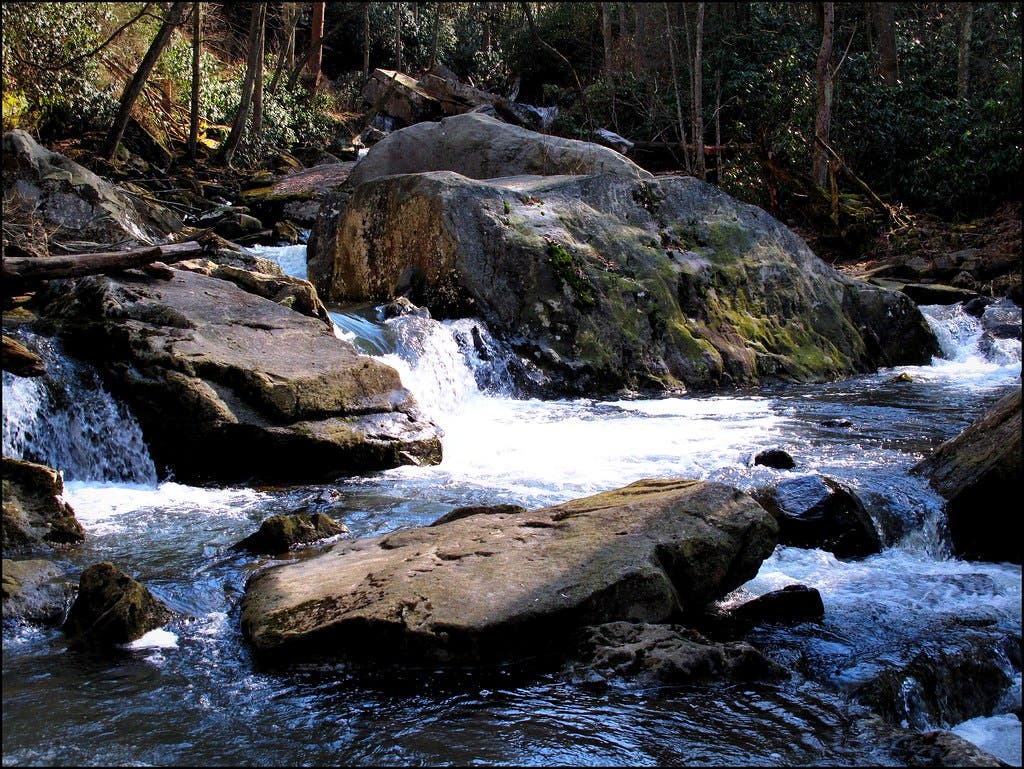
West’s favorite weekend trip is Glade Creek Trail, an 11.2-mile out-and-back that follows an abandoned railroad along the titualar creek. Start from Glade Creek Campground, which offers first-come-first-serve camping. Flyfishing enthusiasts should bring a pole; the lower part of the creek is stocked with trout. West enjoys the cascading waterfalls and swimming holes along the path, as well as the solitude. “It’s a great hike if you’re looking for some quiet,” she says. “It’s a little bit away from things.” Spend the night at one of the campsites scattered along the furthest two miles of the trail to spot some of the park’s ten documented species of bats, including the endangered Virginia big-eared bat and Indiana bat.
Multi-Day Trek: Thurmond/Cunard to Fayetteville Trails
If you’re looking for longer than a weekend in the backcountry, West recommends a 23.3-mile circuit connecting ten of the park’s trails. (When planning where to spend your nights be sure to familiarize yourself with the zones where camping is prohibited, which you can find here.) The path wanders past old mine sites, river views, and multiple creeks on its way up and down the gorge, and is best done as an end-to-end, with one vehicle dropped at the Bridge Trail parking lot before heading to the starting point at the Rend Trail trailhead.
“If you’re going to leave a vehicle at a trailhead [overnight], it’s good to let us know ahead of time,” says West. She recommends calling the Canyon Rim Visitor Center to let them know your information and how long you plan on leaving your car.
Once your transport is secured, start by following Rend Trail through lush forest (interspersed with occasional cliffs) along Dunloup Creek. At around mile 1.2, you’ll veer onto the Arbuckle Connector Trail, then left on the Southside Trail, which parallels the river for 7 miles. Southside Trail ends at Brooklyn Campground, where you can pitch your tent amid the comfortable shade of on the first night. In the morning, follow the gravel road from the campground to Cunard River Access before hitting a stretch of paved road. West notes that this paved stretch is narrow and can get very busy with boater traffic, and recommends timing this part of your hike to avoid high-traffic times like Saturday mornings. Follow the road until you hit the Kaymoor trailhead, then follow the Kaymoor Trail along a flat bench midway up the gorge.
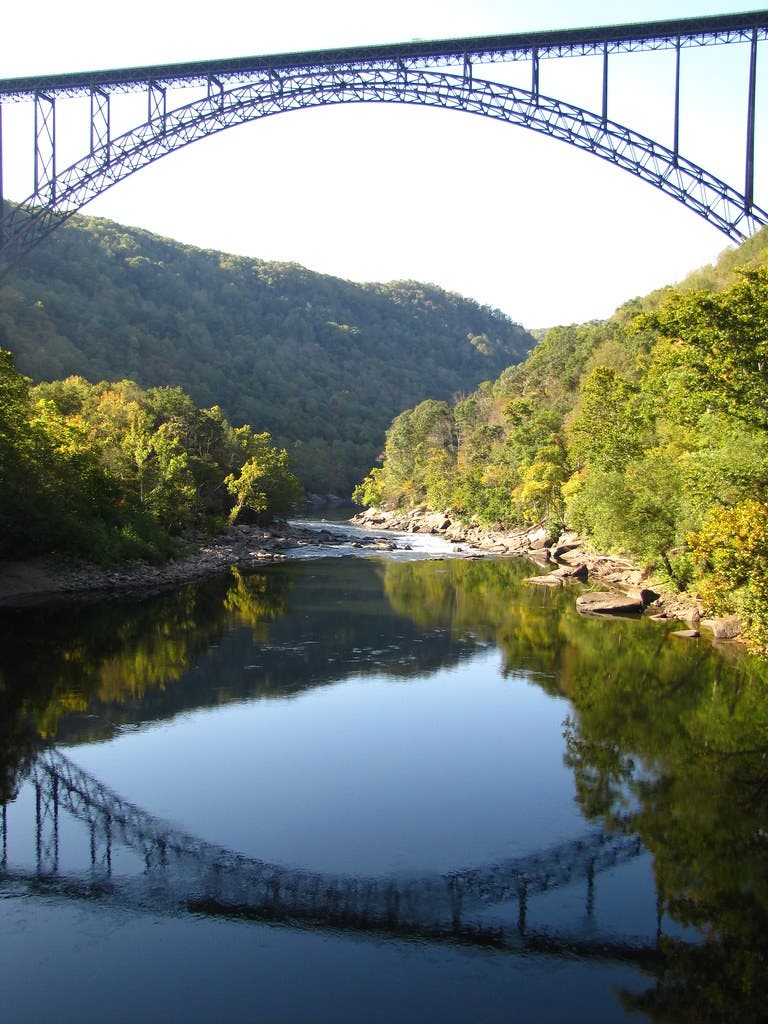
Old mining equipment is visible along this stretch, where the longest-running coal mine on New River was once located. Turn onto the Kaymoor Miners Trail soon after, then turn onto the Butcher Branch Trail a mile later. The next turn is a right on Long Point Trail, taking you on an optional out-and-back to panoramic views of the Gorge and river below, as well as the broad arch of 3,030-foot-long New River Gorge Bridge. If you don’t need the extra views and miles, turn left instead, continuing onto the Fayetteville Trail and then the Bridge Trail all the way to your car.
ADVERTISEMENT
Postcard View
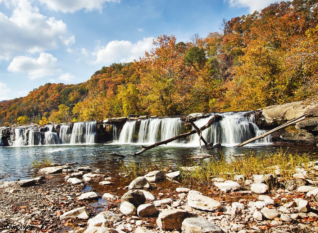
According to West, a trip to New Gorge isn’t complete without seeing 1,500-foot-wide Sandstone Falls. “It’s the largest waterfall on the entire 320-mile river,” says West. A boardwalk leads hikers out over the river for a truly all-encompassing view of the falls. The entire river drops here from narrow mountain gorge into broad bottomlands in a stairstep cascade, broken by several mid-river islands which house one of the region’s most unique ecosystems–Appalachian riverside flat rock plants.
Trip Planner
Season year-round Permit none Contact New River Gorge National Park