Navigate: Whiteout, Darkness, and Fog
Just because you can't see in front of you doesn't mean you can't navigate.
NAVIGATE:Forests/Mountains |
Canyons/Deserts |
Lakes/Oceans |
Off-Trail

clutch skill
Take Waypoints From a Map
After summiting Canada’s remote Twins Tower, gear trouble forced alpinist Steve House and his partner to tackle an unplanned route to the highway: 17 miles across the Columbia Icefield—in a whiteout. House pulled new coordinates from his map, entered them into his GPS, and safely navigated the nine-hour journey to the road. Although it’s easier and more accurate to plot waypoints at home using software, you may need to do it in the field if your course changes due to weather, an accident, or altered objectives. Here’s how:
1. Some maps have a UTM overlay grid, usually with each square representing one-square kilometer. Find the grid lines just to the west and south of each waypoint you plan to mark. If there’s no grid, find the blue tick marks next to the UTM easting and northing coordinates along the map’s edges, and use them to draw grid lines. Note the lines’ coordinates (e.g., 0363000E and 4029000N (A)).
2. Measure the distance east and north of these lines to the waypoint. Use a UTM grid reader or compass baseplate ruler appropriate for your map scale. Or, trace your map’s one-kilometer bar scale on scrap paper, and divide it into 10 increments of 100 meters each (B). Replace the final three numbers in the coordinates with the distances east and north to the waypoint in meters (e.g. 0363274E and 4029262N (C)).
3. Find the map’s zone number (usually in the lower-left corner), and add it to the easting (e.g. 12S 0363274E).
4. Enter the coordinates for each waypoint into your GPS. (House plotted eight.) Be sure to match the GPS datum with the map datum. On the GPS, select the first waypoint, press GoTo, and follow the displayed direction. To save power, note the bearing and navigate by compass, checking the GPS periodically. No GPS? Double the number of waypoints (since following a compass raises the likelihood for error), take the bearing for each leg from the map, and follow the compass bearings in turn.
Prep Your Map with Key Bearings
During a blizzard or high winds, taking accurate bearings from a map may be impossible. Follow the example of mountaineers on Scotland’s Ben Nevis, who annotate their maps with two crucial bearings (231 degrees and 282 degrees) and the distance of the first leg (150 meters) needed to navigate off the cliff-girded summit during whiteouts, enabling them to dial in their bearing and go.
Follow a Contour
You can navigate a fog-shrouded hillside with just a map and altimeter. First, note your elevation, and find that contour line at your approximate location on the map. Now, use the altimeter to follow that contour toward a handrail feature such as a sharp ridge, streambed, or road. When you reach the handrail, you are located precisely where the contour line intersects that feature on the map.
Cast a Line for Visibility
Fog or blowing snow may skew depth perception. To mitigate vertigo and reveal hidden obstacles, Alaskan guide Joe Stock recommends “fly casting.” Tie a 20-foot length of brightly colored rope to a ski pole or ice axe, and cast the cord onto the snow as you travel across a snowfield or glacier.
Leapfrog to Stay On Course
Holding a bearing is tough if fog hides landmarks. Send one person ahead in line with the bearing till you begin to lose sight of him. Yell “right” and “left” or use hand signals to reposition him. Regroup at the new spot; repeat.
Key Gear
1. Lowrance Endura Sierra. This user-friendly, versatile GPS unit comes preloaded with topos for all of the continental states (and thousands of key trail waypoints). Compass and altimeter? Check. Bonus: Its 4GB internal memory lets you upload photos or video of your route. $550; 6.2 oz.; lowrance.com

2. Mammut’s X-Zoom can blast a beam 100 yards into the night (on the max brightness setting) or cast a soft glow over your map (in diffuse mode). Plus, battery life is mega; our test model burned 36 hours straight on high. $100; 7.3 oz. (with 3 AAAs); mammut.ch

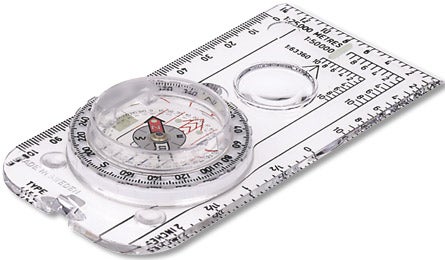
3. Brooks-Range’s All-in-One UTM Grid Reader lets you measure distances and plot precise waypoints on the map, so you can transfer them from your map to the GPS or vice versa. With eight scales, the reader works with almost all map types. $6; brooks-range.com
Photos by Courtesy
