Navigate: Forests and Mountains
Skirt forests and mountains with ease with these tips and gear.
NAVIGATE:Whiteout/Darkness/Fog |
Canyons/Deserts |
Lakes/Oceans |
Off-Trail
clutch skill
Skirting Obstacles
Whether in the Cascades or the Everglades, you typically can’t beeline toward your bearing; at some point, a blowdown, cliff band, pond, or some other barrier will block your path. To bypass it while still staying on course, do the following:

1. Turn 90 degrees right or left from your bearing. You don’t have to calculate a new bearing—just sight along the front or back edge of your compass’s baseplate, perpendicular to the direction-of-travel arrow.
2. Count paces until you’re past the obstacle. A pace is a double-step—count every left or right footstep. (The original Roman “mile” was 1,000—or mille—double-steps.)
3. Turn and walk your original bearing until you’ve passed the obstacle. Now turn 90 degrees again—leftward if you turned right at the start and vice versa. Count the same number of paces; then resume your original course.
Pace counting is rarely effective beyond about 200 paces—roughly a quarter-mile. To improve accuracy, note the time you travel on the outward leg, and try to match both time and pace count on the return leg.
Got Height?
You can easily pinpoint your position along a trail, creek, or ridgeline using just an altimeter and map. First, check the altitude on your altimeter. Then find the contour line closest to your elevation, and note where it intersects the trail, stream, or ridge. That is where you are. This technique works best during a steady ascent or descent, since undulating trails or rolling terrain may cross a contour line multiple times.
3 Factors That Can Skew Your Compass Reading:
>> Metal from a car, camera, drainage pipes, carabiners
>> Electrical fields from powerlines or a running car engine
>> Other magnetic forces, such as some lava beds, black sand, and half-finger gloves where magnets hold the mitten hood back
Calibrate Often
Recalibrate your altimeter every time you arrive at a known elevation, such as a pass or lake, since altimeter readings shift with any weather change that raises or lowers air pressure.
Keep Your GPS Locked On
Before entering thick woods, acquire satellites on your GPS, then pause for a new fix at each clearing or hilltop. To improve reception, hold the unit at eyelevel.
Use Common Sense
Your best navigation tools are your eyes and brain. If your map and compass place you on a steep slope but you’re standing on level ground, check your work.
Read Terrain on a Map
On a topographic map, the contour lines reveal an area’s three-dimensional landscape. Each line represents a specific elevation; the vertical change from one line to the next is a fixed value for that map (called the contour interval, it’s 40 feet on 7.5-minute USGS topos, the preferred map for backcountry navigation). Here’s how to identify key terrain features:
>> Cliffs Contour lines are very close together, almost touching.
>> Valleys and couloirs These have U-shaped contour lines, with the curve of the U pointing uphill; steep valleys or ravines resemble a V.
>> Summits Contour lines form concentric circles; the summit is the innermost and highest circle.
>> Flat or gently sloped areas Widely spaced contour lines
>> Passes/saddles Contour lines form an hourglass; the center of the hourglass will have higher lines on two sides (e.g., north and south of center) and lower lines on the opposite two sides (e.g., east and west of center).
Key Gear
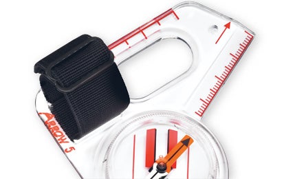
1. Strap Suunto’s Arrow 5 onto your thumb and you’ll have your compass at the ready for constant consults—a huge plus when navigating obstacle-ridden forest. $45; .9 oz.; suunto.com

2. With a big, easy-to-read face, the Timex Expedition WS4 altimeter watch gives you precise altitude readings at a glance. It also features our favorite barometric pressure graph, so you can predict incoming weather. $200; 3 oz.; timex.com
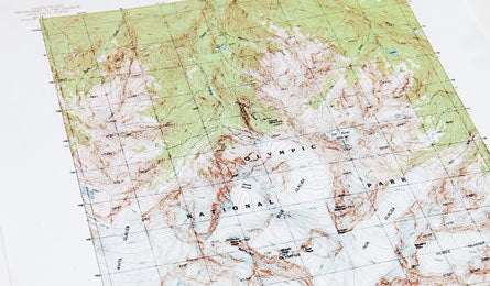
3. No need to spend beaucoup for maps. Download free topos in PDF format from usgs.gov and print them out at home.

Photos by Courtesy, Map by Julia Vandenoever,and Illustrations by Supercorn