March 2008 Essentials Review: Navigation

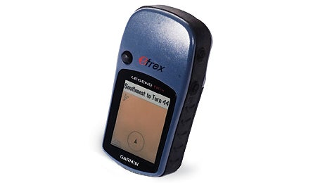
Garmin eTrex Legend HCx

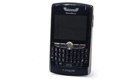
Blackberry 8800, 8820, 8310

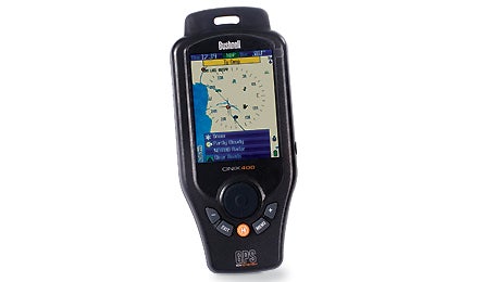
Bushnell Onix 400

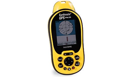
DeLorme Earthmate GPS PN-20
Blackberry 8800, 8820, 8310
The world’s favorite smartphone is now ready to hike, bike, and geocache: With a suite of software applications from Trimble Outdoors (trimbleoutdoors.com; $40/year), the latest Blackberry models double as GPS units no matter how far you are from a city or cell network. The Blackberry locks onto satellites faster than other mobile phone devices we’ve tested, and the mini-keyboard makes it possible to record trail notes on the 2.5-inch screen (it’s easy for small fingers, tougher for big ones). The device tracks important stats: distance, average pace, and compass bearing. Our testers downloaded maps for adventures in Colorado with just a few minutes of PC time. After their trips, they wirelessly sent points, tracks, and photos to the Internet. Bummer: The rechargeable lithium-ion battery lasts only five to six hours. The software works on AT&T and T-Mobile networks. $200-$400; 4.7 oz.; blackberry.com
Bushnell Onix 400
This armored unit is a full-featured GPS with map and aerial photo capabilities as well as a weather station and satellite radio. With an optional XM Nav Weather subscription ($10/month), you can receive location-specific weather reports, forecasts, and real-time Doppler radar that overlays onto your route. You can also sign up for XM tunes and sports channels. The Onix is loaded with other welcome features, like a molded carry loop, an external antenna jack, and a weatherproof rubber cover. The 3.5-inch color screen is razor-sharp and easy to read in the sun. Downside: These features drain the rechargeable lithium-ion battery quickly, especially when you’re using XM services; we got about four hours in our tests with XM active. You can disable the power-hungry radio and screen, then navigate using a red/green light and alarm tones to keep you on course; this extends battery life to 26 hours of continuous use. Other quibbles: The base map and trip computer info are bare bones. Map/imagery downloads ($1/sq. km., or $79/year) are expensive because they’re so detailed. (Hint: Get the annual subscription, then store them on your computer.) The Onix also uploads/downloads only through Bushnell’s software, which, like its website, was glitchy at press time (check for updates). $500; 11 oz.; bushnell.com
DeLorme Earthmate GPS PN-20
This compact unit delivers the most accurate, high-resolution track logs we’ve seen in a handheld GPS. Some credit goes to the PN-20’s processor, and some to its massive memory. It comes with 75MB internal flash storage and takes SD cards up to 2GB. In the field, the PN-20 ran for 10-14 hours on two lithium AAs. But onscreen photos were slow to redraw, and there are more user-friendly desktop programs than DeLorme’s Topo USA (included). It’s not the most newbie-friendly interface, but for tech-savvy navigators, the PN-20 has the best details and onscreen maps around. It also works well on Macs running Parallels software, and it’s available with accessories like an SD card, USB card reader/programmer, car charger, and rechargeable power pack. We recommend the Deluxe package ($450) with all of the above. $370-$450; 5.3 oz.; delorme.com
BEST BUY
Garmin eTrex Legend HCx
For hikers and trail runners who don’t want a bulky unit or lots of screen graphics, this upgrade of a longtime editor favorite strikes a hard-to-beat balance: great reception, solid map functionality, compact dimensions, and long battery life. In our testing, it powered out 25 hours on two alkaline AAs. And like all eTrex units, it fits easily in the hand and features an info-rich trip computer that’s easily customizable for data like average moving speed, overall speed, and rate of climb. It takes micro-SD cards up to 2GB for map storage and tracks (but not waypoints), and connects seamlessly to computers via standard USB. Unlike the similar Vista HCx, it doesn’t have an electronic compass or barometric altimeter, but we’ve never been fans of either of these power-draining, calibration-intensive features. Bonus: It’s the most hassle-free receiver for Mac users running National Geographic’s Topo! software. Gripes: The joystick is touchy–you must remove your gloves if you want to land consistently on the menu or the letter you want. Odometer and speed functions only work when you’re moving faster than 2 mph. And Garmin’s Mapsource topos aren’t highly detailed. $289; 5.6 oz.; garmin.com